13 ATLASES
History of Slovenia in maps
Slovenia as it appears in 13 interactive history atlases, from 264 BC to 2015: Pannonia, Carniola, Slovenia, Yugoslavia. Each era below lists who ruled the land and when control changed, linked to the dated map that shows it.
WW2 is free — every chapter. No sign-up.
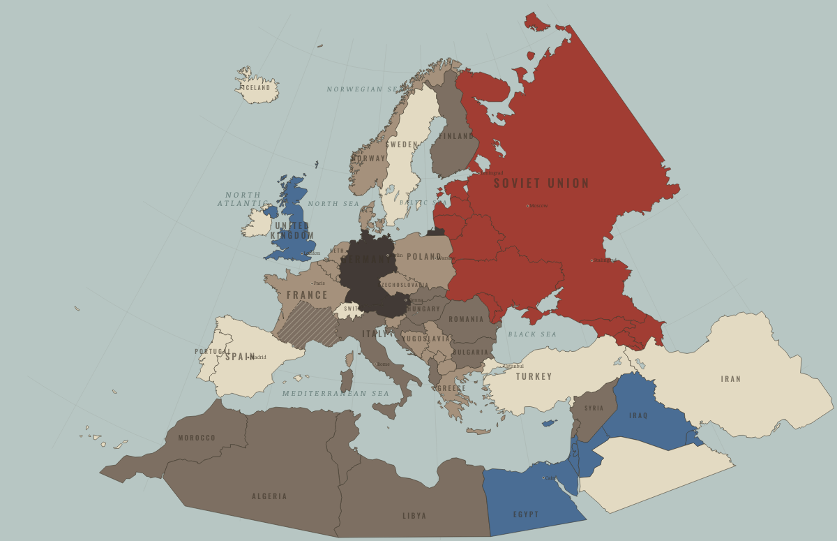
What was Slovenia before it was Slovenia? The sections below follow this land through every era covered by the Maps of History atlases: who ruled it, what it was called, and when control changed. Each line links to the dated map. Modern borders serve as an approximation, as each atlas says on the map itself.
Pannonia (mod. Slovenia) · Ancient Rome
| 264 BC | Tribal peoples & confederations — the opening position |
| Roman territory | |
| Former Roman lands (lost) |
ANCIENT ROME: EVERY CHAPTER AND MAP →
Slovenia · Norse and Aztecs
| Other peoples and states — the opening position |
NORSE AND AZTECS: EVERY CHAPTER AND MAP →
Carniola (mod. Slovenia) · Crusades
| Latin Christendom — the opening position |
CRUSADES: EVERY CHAPTER AND MAP →
Slovenia (Habsburg Empire) · Industrial Revolution
INDUSTRIAL REVOLUTION: EVERY CHAPTER AND MAP →
Slovenia · Age of Revolutions
| The conservative monarchies — the opening position |
AGE OF REVOLUTIONS: EVERY CHAPTER AND MAP →
Yugoslavia (Slovenia; independent from 1991) · Meiji Japan and post-Soviet Russia
| Non-aligned or stateless — the opening position | |
| Independent neighbours |
MEIJI JAPAN AND POST-SOVIET RUSSIA: EVERY CHAPTER AND MAP →
Slovenia (Austria-Hungary) · WWI
Yugoslavia (Slovenia) · Stalin’s Soviet Union
Tito’s partisans fought German occupiers and their local allies from 1941 and took power in 1945 with little help from the Red Army. Yugoslavia had liberated itself, which helps explain why Tito could defy Moscow. He was initially more radical than Stalin wished, yet refused to take orders. Yugoslavia was expelled from the Cominform in June 1948. It survived Soviet pressure, accepted Western aid and built its own non-aligned communism, opening the first crack in the Soviet bloc.
| Nazi Germany & its allies — the opening position | |
| Nazi Germany & its allies | |
| Satellites & communist allies | |
| Other states |
STALIN’S SOVIET UNION: EVERY CHAPTER AND MAP →
Slovenia · Road to WW2
| Neutral & unaligned — the opening position | |
| Occupied — held by force |
ROAD TO WW2: EVERY CHAPTER AND MAP →
Slovenia · WW2
| Axis-occupied — the opening position | |
| Axis-occupied | |
| Soviet Union |
Slovenia · Cold War
| Soviet-aligned states — the opening position | |
| Communist, outside Moscow’s bloc | |
| In upheaval / changing sides | |
| Communist, outside Moscow’s bloc | |
| In upheaval / changing sides |
COLD WAR: EVERY CHAPTER AND MAP →
Yugoslavia (Slovenia) · Feminism and the Tunisian Revolution
| Refused: women excluded; ERA never ratified — the opening position | |
| Right won in law | |
| Partial or unequal; treaty signed only; transition | |
| No reform yet / outside this story | |
| Right won in law |
FEMINISM AND THE TUNISIAN REVOLUTION: EVERY CHAPTER AND MAP →
Yugoslavia (Slovenia) · Refugee crises
The Slovene lands west of the old Rapallo line had belonged to Italy since 1920. For two decades Fascist Italy banned Slovene schools and names; wartime occupation then brought camps such as Rab. In 1947 the area became part of Yugoslav Slovenia. By 1956 most Italians had left Koper and the coastal towns, and Slovene settlers had moved in.
| Soviet-occupied or communist — the opening position |
REFUGEE CRISES: EVERY CHAPTER AND MAP →
Related
THE FREE PRINTABLE STUDY GUIDE
Get a printable atlas study guide of your choice free. I’ll send you a few short letters, then one when a new atlas opens. That’s all. — Paul
NO TRACKING · YOUR ADDRESS IS USED FOR THE DISPATCH AND NOTHING ELSE · UNSUBSCRIBE ANYTIME