MAPS OF HISTORY · FEMINISM AND THE TUNISIAN REVOLUTION · MAPS BY YEAR · 1945Protest and Change: Second-Wave Feminism and Tunisia, 1945–2015 · THE MAP IN 1945
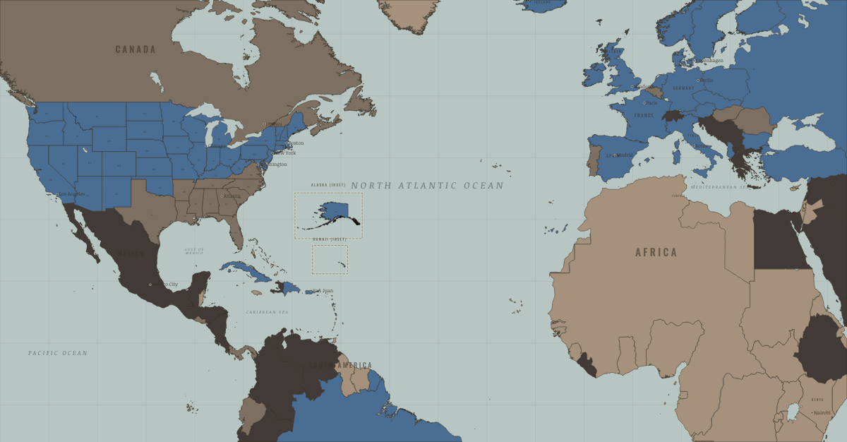
Map of women’s rights in 1945
The vote: where women could vote on equal terms · second-wave feminism
Women’s rights in 1945: The vote: where women could vote on equal terms. The map shows who held what: Right won in law, Authoritarian, one-party or colonial rule, Refused: women excluded; ERA never ratified.
1945 · PROTEST AND CHANGE: SECOND-WAVE FEMINISM AND TUNISIA, 1945–2015 These maps are reconstructed from published sources · Cliopatria v0.2.1 historical polities · Inter-Parliamentary Union: women’s suffrage chronology · Natural Earth 1:10m countries and physical geography · Natural Earth 1:10m administrative references (US states and Berlin)
Source details Cliopatria contributors / Seshat Global History Databank. CC BY 4.0 · Selected source records; component selection, documented unions and date proxies; projected for display. Inter-Parliamentary Union. Factual historical evidence; no source prose reproduced Natural Earth. Public domain · Property selection and semantic ID normalization; full coordinates retained. An upstream Egyptian ring self-intersection is repaired with area change below 1e-9 square degrees; see natural-earth-admin0-review.json. Natural Earth. Public domain Modern reference outlines locate the historical thematic data. The underlying rights/protest classifications remain unchanged.
Germany uses dated East/West source extents together with a Berlin reference; Czechoslovakia, Yugoslavia and the Soviet Union use reviewed historical extents. For Czechoslovakia and the Soviet Union, the 1953–68 references are retained where later Cliopatria records show military occupation rather than treaty-party territory.
The French African territories use the 1945 source polity outline. British/Belgian colonial reporting units remain explicitly modern reference proxies. For the annual 1945 thematic view, Germany/USSR use nearby postwar references.
reconstruction: 1950–1957; 1949–1952 · reconstruction: 1953–1968 · reconstruction: Cartographic device · vector: 1945–1945 · vector: 1953–1968
Layer records and reconstruction methods
Related maps
◧ EMBED THIS MAP ON YOUR SITE
You may embed this map free if you keep the attribution link. Teachers can find print-ready
study guides at /study/ .
THE FREE PRINTABLE STUDY GUIDE
Get the printable study guide for Protest and Change free. I’ll send you a few short letters, then one when a new atlas opens. That’s all. — Paul
NO TRACKING · YOUR ADDRESS IS USED FOR THE DISPATCH AND NOTHING ELSE ·
UNSUBSCRIBE ANYTIME