MAPS OF HISTORY · INDIAN INDEPENDENCE · BATTLES AND EVENTS · Kashmir’s accession to IndiaIndian independence · TURNING POINT · 1947
Kashmir’s accession to India (1947)
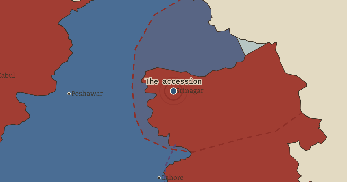
On the Indian independence map as “Srinagar — the accession”
26–27 Oct 1947 — Raiders were forty miles away when Maharaja Hari Singh signed Kashmir over to India. Indian troops landed at the airfield at dawn. Whether the signature preceded the landing remains disputed, as does the question the accession opened.
When 26–27 Oct 1947 Type Turning point Chapter Aftermath of Partition (chapter 14 of Indian independence)Atlas Indian Independence & Partition, 1857–1964 TURNING POINT · INDIAN INDEPENDENCE & PARTITION, 1857–1964 These maps are reconstructed from published sources · Cliopatria v0.2.1: dated historical polity records · National Archives of India: Abhilekh Patal historical records portal · Natural Earth v5.1.2: complete country reference geometry · Natural Earth: administrative reference units · UK National Archives: the Partition of British India · Imperial Gazetteer of India (1908): Indian Empire political plate
Source details Cliopatria contributors / Seshat Global History Databank. CC BY 4.0 · Reviewed record selection; East/West Pakistan selected as complete components; source dates and identities retained. National Archives of India; contextual historical records, not a boundary survey. Historical factual reference; no source prose reproduced Natural Earth. Public domain Natural Earth. Public domain · Full components retained and dissolved into explicitly dated historical groups; no source-coordinate simplification. UK National Archives; award and independence context, not modern boundary geometry. Historical factual reference; no source prose reproduced J. G. Bartholomew / Imperial Gazetteer of India, 1908; scan Fowler & Fowler. Public domain · Native-resolution colour-boundary extraction; printed graticule registration; printed label holes removed, territorial enclaves retained. 1908 geography is explicitly a nearby-date proxy in earlier chapters. Partition and Kashmir lines use the closest downloadable successor boundary references. Later river and enclave changes, and the 1972 LoC adjustments, are not represented as exact 1947/1949 surveys.
proxy: 1947 award; modern same-border reference · proxy: Contemporary regional reference · proxy: Historical enclave, source-vintage outline · proxy: Modern same-enclave reference · proxy: Natural Earth v5.1.2 · proxy: Sikkim protectorate, contemporary same-unit outline · reconstruction: Event-specific regional reporting units; source-vintage geography · trace: 1908 printed plate; explicit earlier-date proxy when bound to earlier chapters · vector: 1890–2023 · vector: 1947–1975 · vector: 1948–1949 · vector: 1948–1952 · vector: 1948–1962 · vector: 1948–1968 · vector: 1948–1986
Layer records and reconstruction methods
In the same chapter
Related
THE FREE PRINTABLE STUDY GUIDE
Get the printable study guide for Indian Independence & Partition free. I’ll send you a few short letters, then one when a new atlas opens. That’s all. — Paul
NO TRACKING · YOUR ADDRESS IS USED FOR THE DISPATCH AND NOTHING ELSE ·
UNSUBSCRIBE ANYTIME