11 ATLASES
History of Myanmar in maps
Myanmar as it appears in 11 interactive history atlases, from 1206 to 2000: Kingdom of Pagan, Burma, Myanmar. Each era below lists who ruled the land and when control changed, linked to the dated map that shows it.
WW2 is free — every chapter. No sign-up.
What was Myanmar before it was Myanmar? The sections below follow this land through every era covered by the Maps of History atlases: who ruled it, what it was called, and when control changed. Each line links to the dated map. Modern borders serve as an approximation, as each atlas says on the map itself.
Kingdom of Pagan (mod. Myanmar) · Mongol Empire
| Beyond the conquests — the opening position | |
| Tributaries & vassals |
MONGOL EMPIRE: EVERY CHAPTER AND MAP →
Burma · Industrial Revolution
| Colony or dependency — the opening position | |
| Colony or dependency |
INDUSTRIAL REVOLUTION: EVERY CHAPTER AND MAP →
Burma (British from 1886) · Meiji Japan and post-Soviet Russia
| Independent neighbours — the opening position | |
| Western powers and allies |
MEIJI JAPAN AND POST-SOVIET RUSSIA: EVERY CHAPTER AND MAP →
Burma (annexed 1826–86; separated from India 1937) · Indian independence
Burma belonged to British India until 1937. Britain had taken its coast in 1826 and 1852, then conquered the inland kingdom from Mandalay in 1885. Governed from Calcutta and Delhi, Burma supplied rice to Bengal. It became a separate colony in 1937, only to become some of the war’s most broken ground: occupied and fought over twice, its economy erased. Aung San’s Burma refused the Commonwealth and gained independence on 4 January 1948, at an hour set by astrologers; its founder had been assassinated six months before. Separation spared Burma partition’s knife, but it also cost the country India’s institutional ballast. Its post-independence decades were harder for both reasons.
| Beyond the Raj · Portuguese & French India — the opening position | |
| British India — direct rule | |
| Crown colonies · Burma after 1937 | |
| Self-rule / independent |
INDIAN INDEPENDENCE: EVERY CHAPTER AND MAP →
Burma (British India) · WWI
| Entente-aligned & imperial territories — the opening position |
Burma (British to 1948) · Chinese Revolution
A road through British Burma gave besieged Free China a route for supplies. The 1,100-kilometer mountain road from Lashio to Kunming was dug largely by hand in 1937–38. Japan’s conquest of Burma in 1942 cut it, closing China’s last land door. In 1945 the Ledo Road reopened the route through jungle at fantastic cost. The same war carried Burma’s own nationalists, Aung San’s generation, toward independence in 1948. The British empire in Asia did not survive the decade in which this map ends.
| Foreign empires — British, French, Russian, American — the opening position | |
| The Empire of Japan & its puppets | |
| Foreign empires — British, French, Russian, American |
CHINESE REVOLUTION: EVERY CHAPTER AND MAP →
Burma (British) · Road to WW2
| Colonial empires & possessions — the opening position |
ROAD TO WW2: EVERY CHAPTER AND MAP →
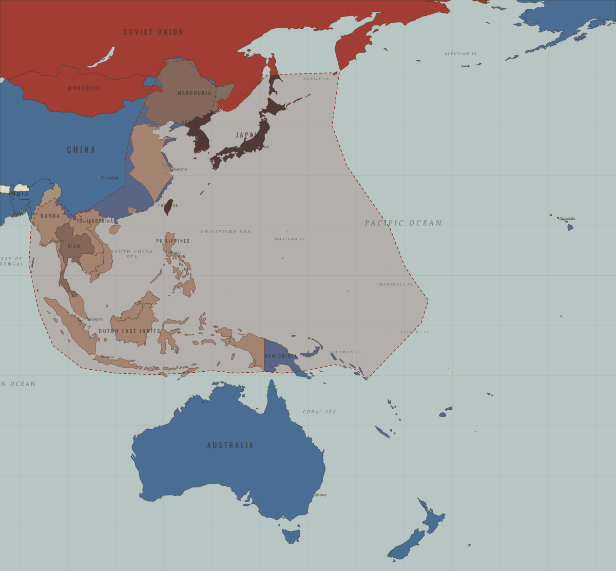
Myanmar · WW2
When Burma fell in 1942, the Burma Road lifeline to China was cut. Britain’s longest campaign of the war brought Burma back in 1944–45, after Imphal and Kohima. Independence followed in 1948, while the wartime mobilization of ethnic militias still echoes in its conflicts.
| Western Allies — the opening position | |
| Axis-occupied | |
| Western Allies |
Burma · Cold War
| NATO & core Western allies — the opening position | |
| Non-aligned & neutral |
COLD WAR: EVERY CHAPTER AND MAP →
Burma · Refugee crises
REFUGEE CRISES: EVERY CHAPTER AND MAP →
Burma · Mao’s China
| Neutral, non-aligned or colonial — the opening position |
MAO’S CHINA: EVERY CHAPTER AND MAP →
Related
THE FREE PRINTABLE STUDY GUIDE
Get a printable atlas study guide of your choice free. I’ll send you a few short letters, then one when a new atlas opens. That’s all. — Paul
NO TRACKING · YOUR ADDRESS IS USED FOR THE DISPATCH AND NOTHING ELSE · UNSUBSCRIBE ANYTIME