11 ATLASES
History of Morocco in maps
Morocco as it appears in 11 interactive history atlases, from 264 BC to 2015: Mauretania, Morocco. Each era below lists who ruled the land and when control changed, linked to the dated map that shows it.
WW2 is free — every chapter. No sign-up.
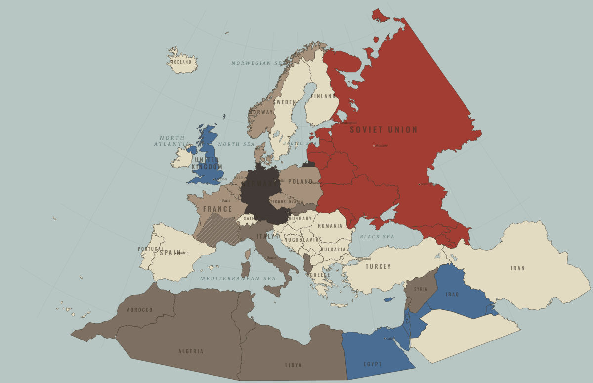
What was Morocco before it was Morocco? The sections below follow this land through every era covered by the Maps of History atlases: who ruled it, what it was called, and when control changed. Each line links to the dated map. Modern borders serve as an approximation, as each atlas says on the map itself.
Mauretania (mod. Morocco) · Ancient Rome
Juba II, educated in Italy, ruled Mauretania as a Roman client king with Cleopatra Selene, daughter of Antony and Cleopatra. At Caesarea (Cherchell), their court combined local and Greco-Roman traditions. Caligula had their son Ptolemy killed in AD 40, reportedly because his cloak attracted attention at the games. Revolt followed, then annexation. Rome governed the region as two provinces. Imperial control weakened in the fifth century, and in 429 the Vandals crossed it on their way to richer lands in Africa.
| 264 BC | Tribal peoples & confederations — the opening position |
| 30 BC | Roman clients & allies |
| Roman territory | |
| Former Roman lands (lost) |
ANCIENT ROME: EVERY CHAPTER AND MAP →
Morocco · Industrial Revolution
| Colony or dependency — the opening position | |
| Colony or dependency |
INDUSTRIAL REVOLUTION: EVERY CHAPTER AND MAP →
Morocco · Age of Revolutions
| Neutral / uncommitted — the opening position |
AGE OF REVOLUTIONS: EVERY CHAPTER AND MAP →
Morocco · Meiji Japan and post-Soviet Russia
MEIJI JAPAN AND POST-SOVIET RUSSIA: EVERY CHAPTER AND MAP →
Morocco · WWI
The independent sultanate of Morocco became the prize in two crises. Germany tried to break the Anglo-French entente through the Kaiser’s ride in Tangier in 1905 and the gunboat at Agadir in 1911 (Ch. 1–2). Both attempts brought Britain and France closer. France made Morocco a protectorate in 1912, Spain took a northern strip, and resistance in the Rif mountains continued into the 1920s.
| Entente-aligned & imperial territories — the opening position | |
| Entente-aligned & imperial territories |
Morocco · Road to WW2
| Colonial empires & possessions — the opening position |
ROAD TO WW2: EVERY CHAPTER AND MAP →
Morocco · WW2
| Western Allies — the opening position | |
| Axis allies & puppets | |
| Western Allies |
Morocco · Cold War
| NATO & core Western allies — the opening position | |
| Non-aligned & neutral | |
| Non-aligned & neutral |
COLD WAR: EVERY CHAPTER AND MAP →
Morocco · Decolonization of Africa
Morocco regained independence in March 1956. It had been a French protectorate with a Spanish northern zone; France now released its protectorates as it chose to concentrate its strength on Algeria. Sultan Mohammed V, whom the French had exiled in 1953, returned as a hero of independence and founded the monarchy that still rules. Morocco later absorbed most of Spanish Sahara, a claim that remains disputed.
| French-ruled — the opening position | |
| Independent Africa |
DECOLONIZATION OF AFRICA: EVERY CHAPTER AND MAP →
Morocco · Feminism and the Tunisian Revolution
| Authoritarian, one-party or colonial rule — the opening position | |
| Right won in law | |
| No reform yet / outside this story |
FEMINISM AND THE TUNISIAN REVOLUTION: EVERY CHAPTER AND MAP →
Morocco · Refugee crises
| Western bloc or democracy — the opening position |
REFUGEE CRISES: EVERY CHAPTER AND MAP →
Related
THE FREE PRINTABLE STUDY GUIDE
Get a printable atlas study guide of your choice free. I’ll send you a few short letters, then one when a new atlas opens. That’s all. — Paul
NO TRACKING · YOUR ADDRESS IS USED FOR THE DISPATCH AND NOTHING ELSE · UNSUBSCRIBE ANYTIME