11 ATLASES
History of Laos in maps
Laos as it appears in 11 interactive history atlases, from 1840 to 2000: Laos, French Indochina, French Indochina — Laos. Each era below lists who ruled the land and when control changed, linked to the dated map that shows it.
WW2 is free — every chapter. No sign-up.
What was Laos before it was Laos? The sections below follow this land through every era covered by the Maps of History atlases: who ruled it, what it was called, and when control changed. Each line links to the dated map. Modern borders serve as an approximation, as each atlas says on the map itself.
Upland principalities (mod. Laos) · Mongol Empire
| Beyond the conquests — the opening position |
MONGOL EMPIRE: EVERY CHAPTER AND MAP →
Laos · Industrial Revolution
| Colony or dependency — the opening position | |
| Colony or dependency |
INDUSTRIAL REVOLUTION: EVERY CHAPTER AND MAP →
Laos (French from 1893) · Meiji Japan and post-Soviet Russia
| Independent neighbours — the opening position | |
| Western powers and allies |
MEIJI JAPAN AND POST-SOVIET RUSSIA: EVERY CHAPTER AND MAP →
Laos (French Indochina, 1893–1953) · Indian independence
| Beyond the Raj · Portuguese & French India — the opening position |
INDIAN INDEPENDENCE: EVERY CHAPTER AND MAP →
French Indochina · WWI
| Entente-aligned & imperial territories — the opening position |
French Indochina (mod. Laos) · Chinese Revolution
Laos was the quietest province of French Indochina, with royal capitals on the Mekong and a colonial government that neglected it. The upheavals of the period nevertheless reached it: Japan occupied it in 1945, a brief declaration of independence followed, and the French returned. Its later revolution would be an annex of Vietnam’s, as Vietnam’s was an annex of China’s. The connections between these movements ran down the southwest corner of the map.
| Foreign empires — British, French, Russian, American — the opening position | |
| The Empire of Japan & its puppets | |
| Foreign empires — British, French, Russian, American |
CHINESE REVOLUTION: EVERY CHAPTER AND MAP →
French Indochina — Laos · Road to WW2
| Colonial empires & possessions — the opening position |
ROAD TO WW2: EVERY CHAPTER AND MAP →
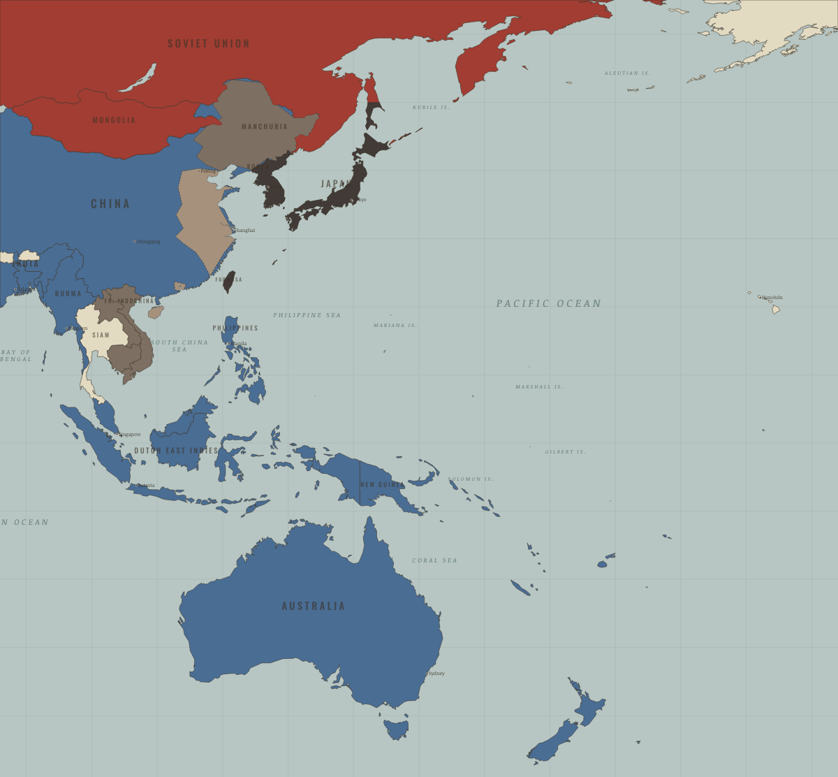
Laos · WW2
| Western Allies — the opening position | |
| Axis allies & puppets | |
| Axis-occupied | |
| Western Allies |
Laos · Cold War
| NATO & core Western allies — the opening position | |
| Non-aligned & neutral | |
| Soviet-aligned states | |
| Communist, outside Moscow’s bloc |
COLD WAR: EVERY CHAPTER AND MAP →
Laos · Refugee crises
The Pathet Lao established the Lao People’s Democratic Republic in December 1975, following a war in which the CIA had armed a Hmong army against it. Over the next twenty years about 360,000 people, roughly one Lao in ten, crossed the Mekong to Thailand. They included highland Hmong and lowland townspeople. About 27,000 returned under the 1989 plan of action.
| Soviet-occupied or communist — the opening position | |
| Soviet-occupied or communist |
REFUGEE CRISES: EVERY CHAPTER AND MAP →
Laos · Mao’s China
| Neutral, non-aligned or colonial — the opening position |
MAO’S CHINA: EVERY CHAPTER AND MAP →
Related
THE FREE PRINTABLE STUDY GUIDE
Get a printable atlas study guide of your choice free. I’ll send you a few short letters, then one when a new atlas opens. That’s all. — Paul
NO TRACKING · YOUR ADDRESS IS USED FOR THE DISPATCH AND NOTHING ELSE · UNSUBSCRIBE ANYTIME