14 ATLASES
History of Albania in maps
Albania as it appears in 14 interactive history atlases, from 264 BC to 2015: Epirus & Illyria, Epirus & Dyrrhachium, Epirus, Albania. Each era below lists who ruled the land and when control changed, linked to the dated map that shows it.
WW2 is free — every chapter. No sign-up.
What was Albania before it was Albania? The sections below follow this land through every era covered by the Maps of History atlases: who ruled it, what it was called, and when control changed. Each line links to the dated map. Modern borders serve as an approximation, as each atlas says on the map itself.
Epirus & Illyria (mod. Albania) · Ancient Rome
Pyrrhus, king of Epirus, fought Rome in Italy from 280 to 275 BC. Conflicts with Illyrian powers later drew Rome across the Adriatic in 229 BC, an early step eastward. The conquest carried a severe human cost. According to the ancient account, Aemilius Paullus’ forces enslaved 150,000 Epirotes in a coordinated operation in 167 BC.
| 264 BC | Hellenistic kingdoms — the opening position |
| 146 BC | Roman territory |
ANCIENT ROME: EVERY CHAPTER AND MAP →
Albania · Norse and Aztecs
| Other peoples and states — the opening position |
NORSE AND AZTECS: EVERY CHAPTER AND MAP →
Epirus & Dyrrhachium (mod. Albania) · Crusades
| Byzantium (and Latin Constantinople 1204–61) — the opening position |
CRUSADES: EVERY CHAPTER AND MAP →
Epirus (mod. Albania) · Mongol Empire
| Other settled powers (Jin China, Christendom, Delhi) — the opening position |
MONGOL EMPIRE: EVERY CHAPTER AND MAP →
Albania · Industrial Revolution
INDUSTRIAL REVOLUTION: EVERY CHAPTER AND MAP →
Albania · Age of Revolutions
| Neutral / uncommitted — the opening position |
AGE OF REVOLUTIONS: EVERY CHAPTER AND MAP →
Albania · Meiji Japan and post-Soviet Russia
| Non-aligned or stateless — the opening position |
MEIJI JAPAN AND POST-SOVIET RUSSIA: EVERY CHAPTER AND MAP →
Albania · WWI
War reached Albania after barely two years of independence. Its borders had been drawn at London in 1913, and its imported German prince had departed within six months. The Serbian retreat crossed Albania (Ch. 6), while Austrian, Italian, French and Greek forces partitioned it in all but name; the secret Treaty of London had already promised portions to three of its “protectors.” Albania survived as a state to 1920 largely because its occupiers exhausted one another. The Congress of Lushnjë also rejected every partition scheme and made Italy fight for Vlorë, which it declined to do for long.
Albania · Stalin’s Soviet Union
| Nazi Germany & its allies — the opening position | |
| Nazi Germany & its allies | |
| Satellites & communist allies |
STALIN’S SOVIET UNION: EVERY CHAPTER AND MAP →
Albania · Road to WW2
| Neutral & unaligned — the opening position | |
| The aggressors (Japan, Germany, Italy) |
ROAD TO WW2: EVERY CHAPTER AND MAP →
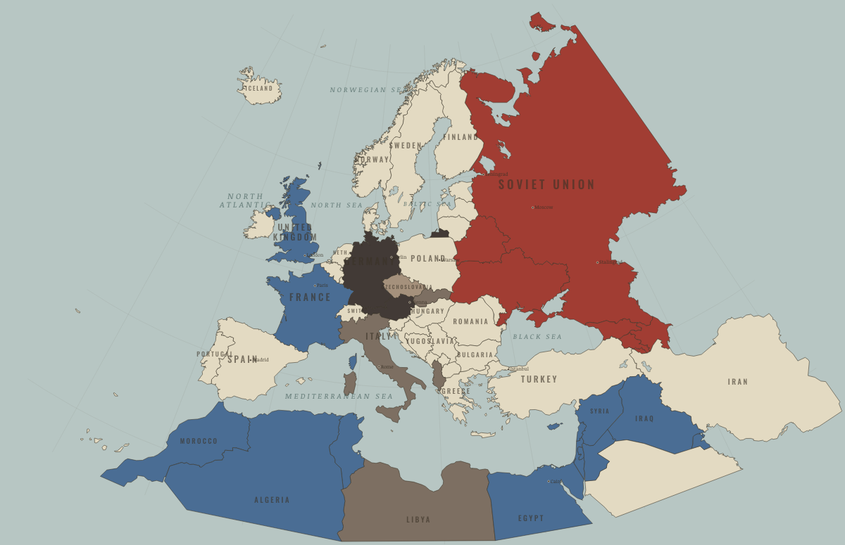
Albania · WW2
| Axis allies & puppets — the opening position | |
| Axis allies & puppets | |
| Soviet Union |
Albania · Cold War
| Soviet-aligned states — the opening position | |
| Communist, outside Moscow’s bloc | |
| Non-aligned & neutral | |
| Communist, outside Moscow’s bloc | |
| Non-aligned & neutral |
COLD WAR: EVERY CHAPTER AND MAP →
Albania · Feminism and the Tunisian Revolution
| Right won in law — the opening position | |
| No reform yet / outside this story |
FEMINISM AND THE TUNISIAN REVOLUTION: EVERY CHAPTER AND MAP →
Albania · Refugee crises
| Soviet-occupied or communist — the opening position |
REFUGEE CRISES: EVERY CHAPTER AND MAP →
Related
THE FREE PRINTABLE STUDY GUIDE
Get a printable atlas study guide of your choice free. I’ll send you a few short letters, then one when a new atlas opens. That’s all. — Paul
NO TRACKING · YOUR ADDRESS IS USED FOR THE DISPATCH AND NOTHING ELSE · UNSUBSCRIBE ANYTIME