MAPS OF HISTORY · STALIN’S SOVIET UNION · BATTLES AND EVENTS · Deportation of the Crimean TatarsStalin’s Soviet Union · SITE OF MEMORY · 1944
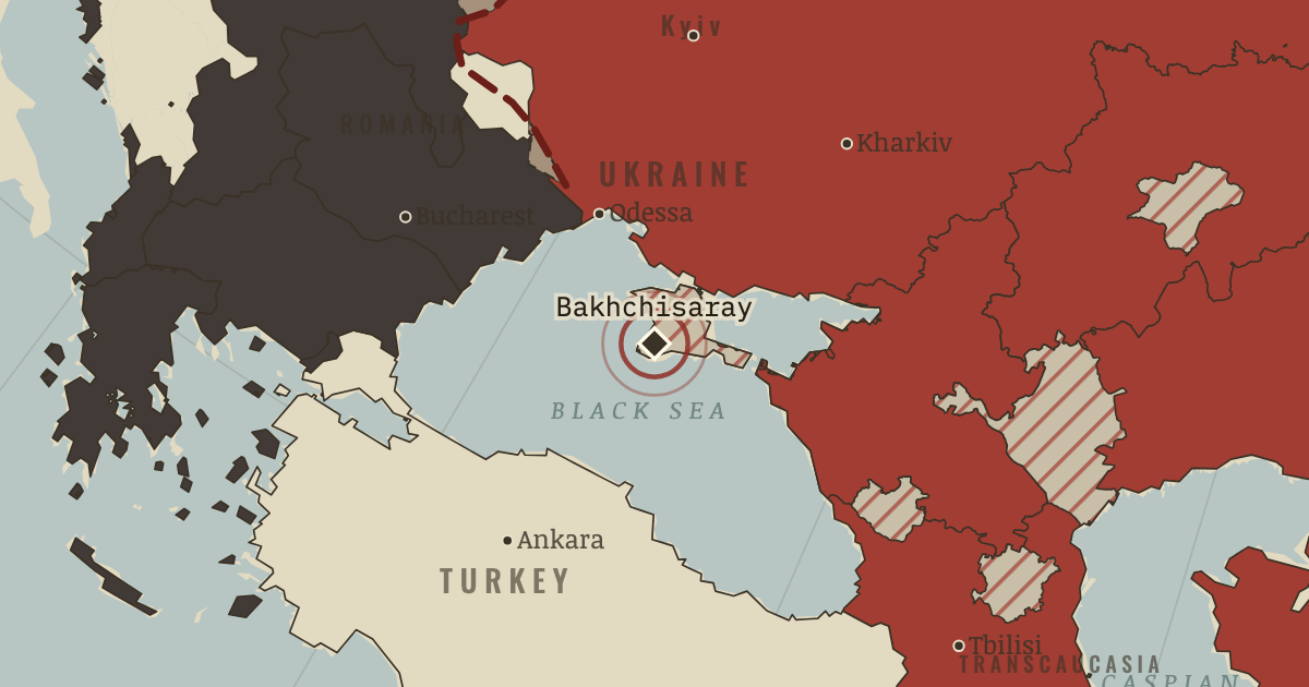
Deportation of the Crimean Tatars (1944)
On the Stalin’s Soviet Union map as “The Sürgün”
18–20 May 1944 — Over three days, the NKVD deported about 191,000 Crimean Tatars, mostly to Uzbekistan. Accounts differ sharply on how many died in the first years: NKVD records put the share at about a fifth, while Crimean Tatar surveys put it at almost half. They could not return home until 1989.
When 18–20 May 1944 Type Site of memory Chapter Stalin’s ethnic deportations (chapter 7 of Stalin’s Soviet Union)Atlas The Soviet Union under Stalin, 1924–1953 SITE OF MEMORY · THE SOVIET UNION UNDER STALIN, 1924–1953 These maps are reconstructed from published sources · Cliopatria v0.2.1 historical political boundaries · Natural Earth v5.1.2 country geography · Natural Earth full administrative reference geometry · Published projection for the Soviet Union location-map family · Bukharan PSR in the Soviet Union (1922), published vector locator · Volga German ASSR, 20 July 1930: published locator map · Cliopatria v 0.2.1 — dated political boundaries · US War Department — Atlas of the World Battle Fronts (1945) · Cliopatria v 0.2.1 — dated political boundaries
Source details Cliopatria contributors / Seshat Global History Databank. CC BY 4.0 · Dated source selection, component unions, disjoint display masks and source-relative border differences. Natural Earth contributors. Public domain Natural Earth contributors. Public domain · Complete selected units and holes; geographic references to named memorial regions, not claims of dated district perimeters. Hellerick. Mathematical projection parameters; source artwork CC BY-SA 3.0 TRAJAN 117, TarzanASG, Anonimu and Milenioscuro; underlying location-map geography by Hellerick/Natural Earth. CC BY-SA 3.0 · Identified Bukhara, Khorezm and historical Aral SVG paths independently inverse-projected; derivative geometry distributed under CC BY-SA 3.0. Fotisgrek. CC BY-SA 4.0 · Native red territorial class extracted and registered to published lake geography; derivative under CC BY-SA 4.0. Cliopatria contributors / Seshat Global History Databank. CC BY4.0 · Dated polity and constituent territory selections; campaign-dependent occupation overlays reconstructed separately. United States War Department, General Staff,1945. US Army official work; public domain Cliopatria contributors / Seshat Global History Databank. CC BY4.0 · Dated polity and constituent territory selections; campaign-dependent occupation overlays reconstructed separately. For May 1944, the closest acquired campaign sheet is dated 15 June 1944, before Operation Bagration. The source date is retained.
proxy: 1944.4 · reconstruction: 1936–1937 · reconstruction: 1936–1937reference forpost1933Manchukuo · reconstruction: 1944 · reconstruction: 1944 settlement · reconstruction: 1944-06-15 · reconstruction: 1944.4 · trace: 1944-06-15 · vector: 1890–2023 · vector: 1922 published political reference; pre-shrink Aral outline · vector: 1936–1944 · vector: 1939–1944 · vector: 1941–1944 · vector: 1942–1945 · vector: 1943–1944 · vector: 1943–1945 · vector: 1943–1946 · vector: 1944–1944 · vector: 1944–1945 · vector: 1944–1946
Layer records and reconstruction methods
In the same chapter
Related
THE FREE PRINTABLE STUDY GUIDE
Get the printable study guide for The Soviet Union under Stalin free. I’ll send you a few short letters, then one when a new atlas opens. That’s all. — Paul
NO TRACKING · YOUR ADDRESS IS USED FOR THE DISPATCH AND NOTHING ELSE ·
UNSUBSCRIBE ANYTIME