MAPS OF HISTORY · MONGOL EMPIRE · BATTLES AND EVENTS · Yam relay systemMongol Empire · TURNING POINT · 1234
Yam relay system (1234)
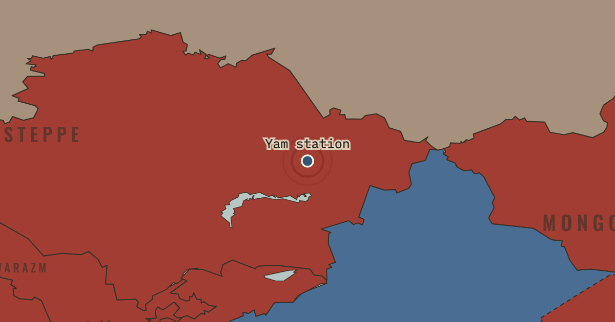
On the Mongol Empire map as “A yam waystation”
1234 — Ögedei decrees a relay network across the empire. Remount stations stand every 25–40 km on its roads, with fodder and riders ready. An order, or a merchant carrying a paiza tablet, can move 300 km a day along routes stretching from Hungary to Korea. The relay gives the conquered territories a means of acting as a state.
When 1234 Type Turning point Chapter How the Mongol Empire was governed (chapter 7 of Mongol Empire)Atlas The Mongol Empire, 1206–1294 TURNING POINT · THE MONGOL EMPIRE, 1206–1294 These maps are reconstructed from published sources · Cliopatria v0.2.1 — historical political boundaries · Asia for Educators — Expansion under Ögödei · Asia for Educators — Collapse of the Empire and Four Sectors · ISEAS Nalanda-Sriwijaya Centre Working Paper 25 — Mongol campaigns · Natural Earth — physical reference geography · Janet Martin — Medieval Russia 980–1584, chronology · Institute of History of Ukraine — Mongol invasion and its consequences
Source details Cliopatria contributors / Seshat Global History Databank. CC BY 4.0 · Selected dated polygons; documented unions, differences and shared edges for event-specific reconstructions; projected for display. Asia for Educators, Columbia University. Text consulted for historical facts; no map or prose copied Asia for Educators, Columbia University. Text consulted for historical facts; no map or prose copied ISEAS–Yusof Ishak Institute. Historical facts consulted; no map or prose copied Natural Earth. Public domain Janet Martin, Cambridge University Press. Historical facts consulted; no map or prose copied Encyclopedia of the History of Ukraine, 2019. Historical facts consulted; thematic geometry independently reconstructed Published polity extents are used at the date resolution available in their sources. Hatched affected regions and route arrows are educational reconstructions; the source details distinguish them from imported boundaries.
Chapter anchor 1254.5 uses the existing snapshot s1254 (1254). The lesson date remains separate from the source reference dates.
proxy: 1206 reference extent · reconstruction: 1188–1259 · reconstruction: 1236–1259 · reconstruction: 1237–1240 · reconstruction: 1250–1259 · reconstruction: 1250–1259 territory; post-1253 allegiance · reconstruction: 1250–1271 · reconstruction: 1250–1278 · reconstruction: 1250–1284 · reconstruction: 1254 · reconstruction: 1254; pre-conquest Tibetan reference 1139–1235 · reconstruction: 1254; regional outlines from pre-conquest 1206 principalities · vector: 1072–1325 · vector: 1072–1374 · vector: 1111–1278 · vector: 1139–1259 · vector: 1188–1259 · vector: 1188–1271 · vector: 1188–1284 · vector: 1188–1304 · vector: 1192–1325 · vector: 1192–1362 · vector: 1202–1259 · vector: 1202–1374 · vector: 1202–1743 · vector: 1210–1304 · vector: 1220–1313 · vector: 1227–1259 · vector: 1236–1259 · vector: 1236–1293 · vector: 1236–1452 · vector: 1241–1271 · vector: 1241–1278 · vector: 1241–1293 · vector: 1241–1313 · vector: 1241–1351 · vector: 1250–1259 · vector: 1250–1271 · vector: 1250–1278 · vector: 1250–1284 · vector: 1250–1293 · vector: 602–1501 · vector: 936–1271
Layer records and reconstruction methods
In the same chapter
Related
THE FREE PRINTABLE STUDY GUIDE
Get the printable study guide for The Mongol Empire free. I’ll send you a few short letters, then one when a new atlas opens. That’s all. — Paul
NO TRACKING · YOUR ADDRESS IS USED FOR THE DISPATCH AND NOTHING ELSE ·
UNSUBSCRIBE ANYTIME