MAPS OF HISTORY · WWI · BATTLES AND EVENTS · Occupation of the RuhrWWI · TURNING POINT · 1923
Occupation of the Ruhr (1923)
On the WWI map as “The Ruhr occupation”
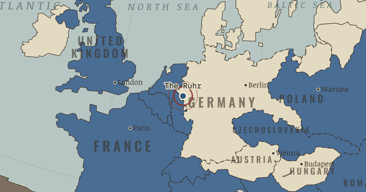
11 Jan 1923 — Germany has fallen behind on reparation deliveries of coal and timber, and French and Belgian troops march into the Ruhr, its industrial heartland. Germany responds with passive resistance and prints money to pay the strikers. By November one dollar costs 4.2 trillion marks.
When 11 Jan 1923 Type Turning point Chapter Europe’s new borders after WWI (chapter 15 of WWI)Atlas The Great War, 1871–1923 TURNING POINT · THE GREAT WAR, 1871–1923 These maps are reconstructed from published sources · Cliopatria v 0.2.1 · Natural Earth physical geography · Maps of History: Great War geographic decisions · US Army: American Forces in Germany · German Federal Archives: occupation of the Ruhr, 1923 · Treaty of Versailles: Rhineland occupation
Source details Cliopatria contributors / Seshat Global History Databank. Source polygons retained with original identities; geographic selections and corrections by Maps of History.. CC BY 4.0 Made with Natural Earth; geographic reference and physical land only. No modern political boundary is used as a historical boundary.. Public domain Maps of History. Campaign-sector connectors and contextual regions are identified separately from imported vector outlines.. Original geographic reconstruction using attributed historical evidence US Army Medical Department history; Moselle Valley from Luxembourg to Rhine, Trier and Koblenz. Boundary derived from treaty river and bridgehead provisions rather than an absent annual control polygon.. US government historical geographic evidence Bundesarchiv,11 January 1923; geographic industrial district occupation.. Historical evidence citation; no artwork copied Versailles articles 428–432; Rhineland occupation and bridgeheads.. Historical treaty facts; original geographic reconstruction Annual source features can describe claims, legal territory or military control. Occupied extensions are separated from the prewar Central Power homelands, while the original source names and shapes remain available.
The displayed state is iss 1923. Geographic reference dates and reconstruction methods are recorded for each feature.
reconstruction: 1919–1923 · reconstruction: 1920–1923 · reconstruction: 1920–1935 · reconstruction: 1922–1923 · reconstruction: 1922–1925 French mandate reference · reconstruction: 1922–1935 · reconstruction: 1923 · reconstruction: 1923.56 · vector: 1815–1937 · vector: 1848–1935 · vector: 1908–1935 · vector: 1912–1955 · vector: 1918–1926 · vector: 1918–1938 · vector: 1919–1923 · vector: 1919–1937 · vector: 1920–1923 · vector: 1920–1931 · vector: 1920–1935 · vector: 1920–1937 · vector: 1920–1939 · vector: 1922–1923 · vector: 1922–1925 · vector: 1922–1931 · vector: 1922–1935
Layer records and reconstruction methods
In the same chapter
Related
THE FREE PRINTABLE STUDY GUIDE
Get the printable study guide for WWI free. I’ll send you a few short letters, then one when a new atlas opens. That’s all. — Paul
NO TRACKING · YOUR ADDRESS IS USED FOR THE DISPATCH AND NOTHING ELSE ·
UNSUBSCRIBE ANYTIME