The American Civil War, 1840–1877 · THE MAP IN
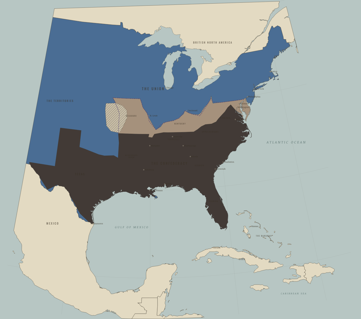
Map of the United States in April 1861
Sumter — the house divides · Civil War
The United States in April 1861: Sumter — the house divides. The map shows who held what: The Union.
Open this map in the interactive atlas →
WW2 is free in full, and chapter 1 of every atlas is free. A free account opens 3 more chapters a day. Starter, at $9 a month, opens all 21 with no daily limit — see the plans.
Free printable American Civil War study guide, sent by email ↓
On the ground
- The Confederacy at its founding extent, with eleven states in rebellion.
- Delaware, Maryland, West Virginia, Kentucky and Missouri were slave states that remained in the Union. Emancipation’s exemptions lasted until the 13th Amendment.
- In the Kansas–Missouri guerrilla country, ambush and reprisal marked the fighting, as did Order No. 11. No front line ever governed this war.
The chapters of this moment
Related maps
THE FREE PRINTABLE STUDY GUIDE
Get the printable study guide for The American Civil War free. I’ll send you a few short letters, then one when a new atlas opens. That’s all. — Paul
NO TRACKING · YOUR ADDRESS IS USED FOR THE DISPATCH AND NOTHING ELSE · UNSUBSCRIBE ANYTIME