MAPS OF HISTORY · RUSSIAN REVOLUTION · MAPS BY YEAR · March 1861The Russian Revolution, 1855–1924 · THE MAP IN MAR 1861
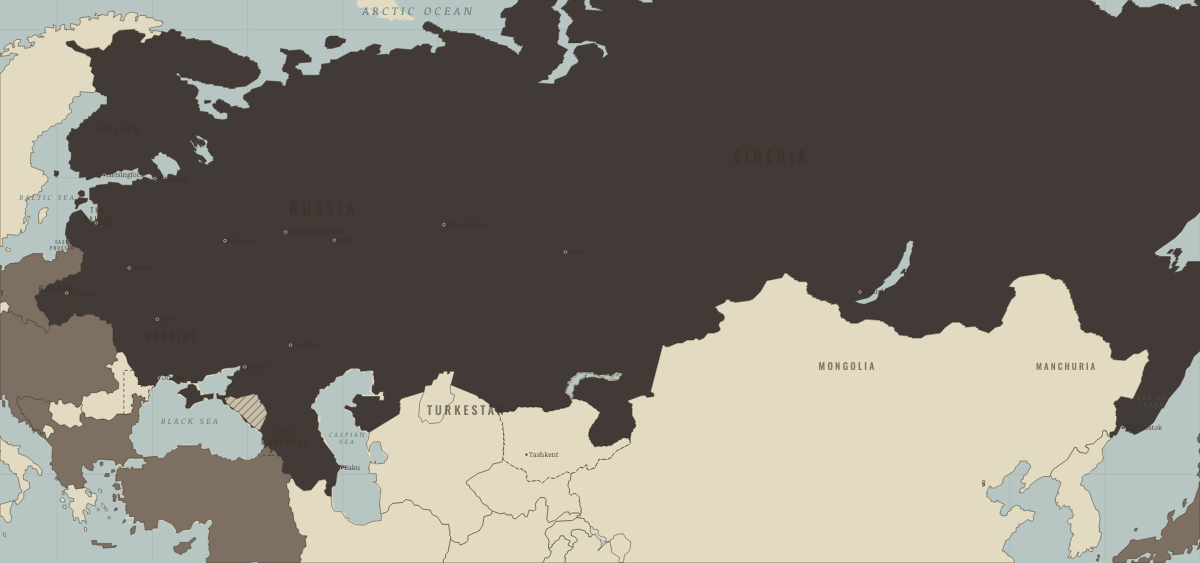
Map of the Russian Empire in March 1861
The serfs are freed
The Russian Empire in March 1861: The serfs are freed. The map shows who held what: The Tsarist empire, Foreign powers & intervention.
MAR 1861 · THE RUSSIAN REVOLUTION, 1855–1924 These maps are reconstructed from published sources · Cambridge Modern History Atlas, map 108 — Russia in Europe (1912) · Cliopatria v0.2.1 — dated political boundaries · C. Perron / Élisée Reclus — Russian Encroachments in Turkestan (1884)
Source details Cambridge Modern History Atlas, map 108 — Russia in Europe (1912). Historical map published before 1931; independently digitized factual geography. Original scan not republished. Cliopatria contributors / Seshat Global History Databank. CC BY4.0 · Dated polity and constituent territory selections; campaign-dependent occupation overlays reconstructed separately. C. Perron / Élisée Reclus — Russian Encroachments in Turkestan (1884). Historical map published before 1931; independently digitized factual geography. Original scan not republished. Imperial borders use dated political outlines. The 1856/1878 Bessarabian settlement and Kars–Batum acquisition are corrected from the published atlas. Turkmen acquisitions follow the 1884 Reclus map, with Merv entering only after 1884.
reconstruction: 1856–1878; 1860 source reference · reconstruction: 1861.17 · trace: 1861.17 · vector: 1861.17
Layer records and reconstruction methods
Related maps
◧ EMBED THIS MAP ON YOUR SITE
You may embed this map free if you keep the attribution link. Teachers can find print-ready
study guides at /study/ .
THE FREE PRINTABLE STUDY GUIDE
Get the printable study guide for The Russian Revolution free. I’ll send you a few short letters, then one when a new atlas opens. That’s all. — Paul
NO TRACKING · YOUR ADDRESS IS USED FOR THE DISPATCH AND NOTHING ELSE ·
UNSUBSCRIBE ANYTIME