6 ATLASES
History of Eritrea in maps
Eritrea as it appears in 6 interactive history atlases, from 1890 to 2015: Eritrea. Each era below lists who ruled the land and when control changed, linked to the dated map that shows it.
WW2 is free in full, and chapter 1 of every atlas is free. A free account opens 3 more chapters a day. Starter, at $9 a month, opens all 21 with no daily limit — see the plans.
Free printable Feminism and the Tunisian Revolution study guide, sent by email ↓
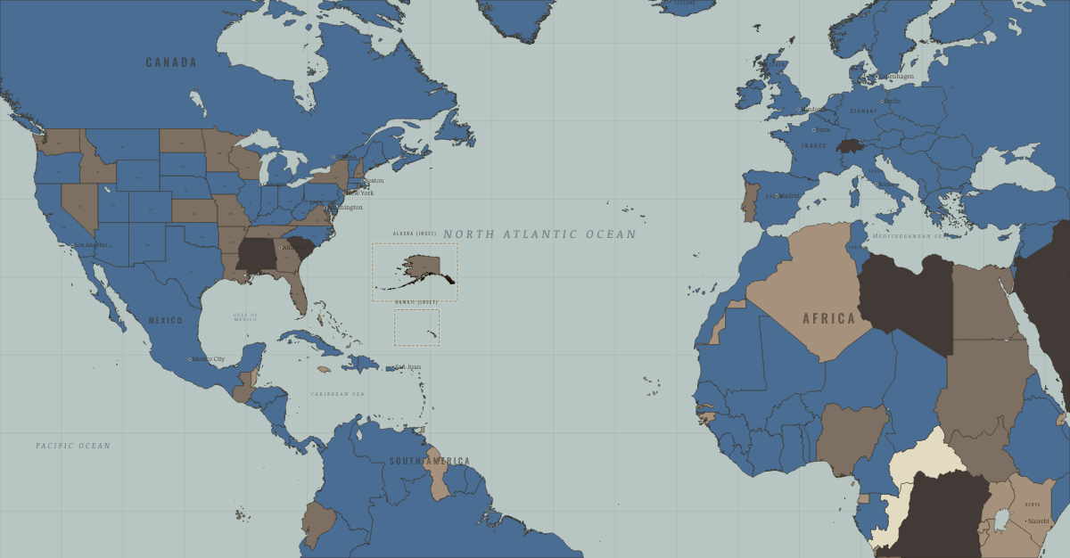
What was Eritrea before it was Eritrea? The sections below follow this land through every era covered by the Maps of History atlases: who ruled it, what it was called, and when control changed. Each line links to the dated map. Modern borders serve as an approximation, as each atlas says on the map itself.
Eritrea · Industrial Revolution
| Colony or dependency — the opening position | |
| Colony or dependency |
INDUSTRIAL REVOLUTION: EVERY CHAPTER AND MAP →
Eritrea · WWI
| Entente-aligned & imperial territories — the opening position | |
| Entente-aligned & imperial territories |
Eritrea (Italian) · Road to WW2
| The aggressors (Japan, Germany, Italy) — the opening position |
ROAD TO WW2: EVERY CHAPTER AND MAP →
Eritrea · Cold War
| US-aligned states — the opening position | |
| Soviet-aligned states | |
| Non-aligned & neutral |
COLD WAR: EVERY CHAPTER AND MAP →
Eritrea · Decolonization of Africa
Italian Eritrea passed to British administration in 1941. In 1952 a UN decision federated it to Ethiopia; Addis Ababa hollowed out that federation and abolished it in 1962. Africa’s longest war of independence ran for thirty years, from Hamid Idris Awate’s first shots in September 1961 to the EPLF’s capture of Asmara in May 1991. It was fought from mountain trenches largely without a superpower patron. Formal independence followed by referendum on 24 May 1993. The map gained its last new flag before South Africa completed it, and a rare exception to the frozen-border rule: a colonial border had been restored rather than redrawn.
| Portuguese, Belgian, Spanish & Italian-ruled — the opening position | |
| Independent before 1945 | |
| Independent Africa |
DECOLONIZATION OF AFRICA: EVERY CHAPTER AND MAP →
Eritrea (part of Ethiopia until 1993) · Feminism and the Tunisian Revolution
| Authoritarian, one-party or colonial rule — the opening position | |
| Right won in law | |
| No reform yet / outside this story | |
| Right won in law |
FEMINISM AND THE TUNISIAN REVOLUTION: EVERY CHAPTER AND MAP →
Related
THE FREE PRINTABLE STUDY GUIDE
Get a printable atlas study guide of your choice free. I’ll send you a few short letters, then one when a new atlas opens. That’s all. — Paul
NO TRACKING · YOUR ADDRESS IS USED FOR THE DISPATCH AND NOTHING ELSE · UNSUBSCRIBE ANYTIME