The Rise and Fall of Rome, 264 BC – AD 476 · THE MAP IN 62 BC
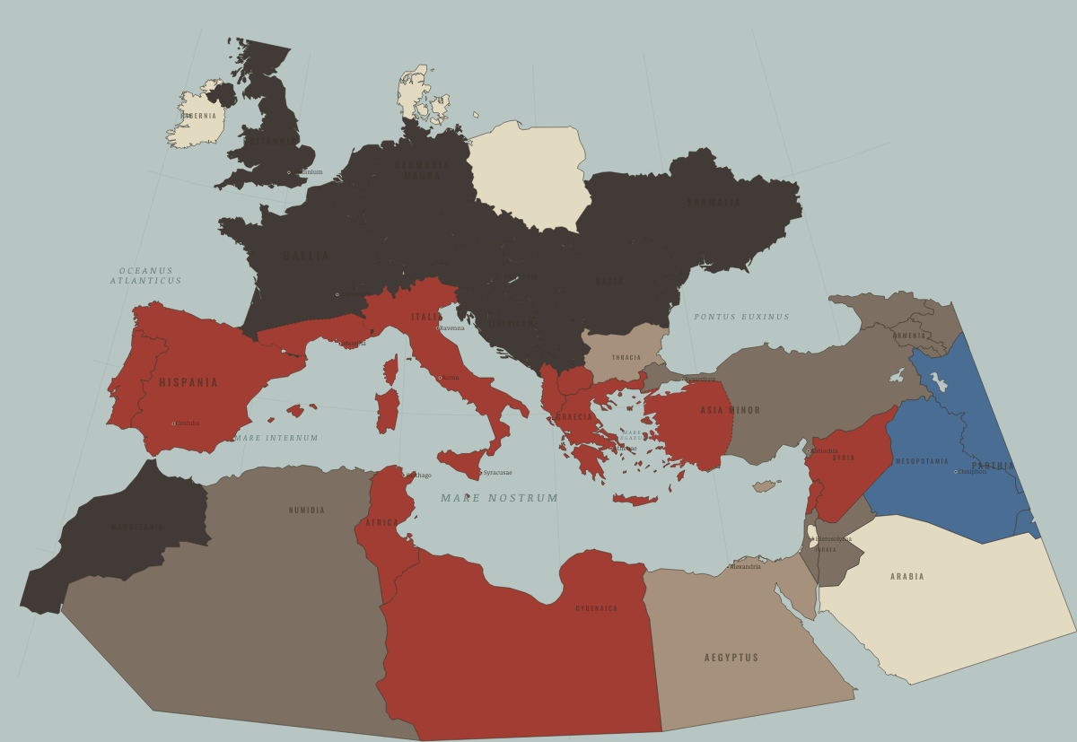
Map of the Roman Republic in 62 BC
Pompey’s East
The Roman Republic in 62 BC: Pompey’s East. Since 133 BC, 9 territories changed status on this map: including Syria, Phoenicia (mod. Lebanon), Judaea (mod. Israel) and 6 more.
Open this map in the interactive atlas →
WW2 is free in full, and chapter 1 of every atlas is free. A free account opens 3 more chapters a day. Starter, at $9 a month, opens all 21 with no daily limit — see the plans.
What changes on the map
| Syria | Hellenistic kingdoms → Roman territory |
| Phoenicia (mod. Lebanon) | Hellenistic kingdoms → Roman territory |
| Judaea (mod. Israel) | Hellenistic kingdoms → Roman clients & allies |
| Nabataea (mod. Jordan) | Hellenistic kingdoms → Roman clients & allies |
| Asia Minor (mod. Turkey) | Hellenistic kingdoms → Roman clients & allies |
| Colchis & Iberia (mod. Georgia) | Hellenistic kingdoms → Roman clients & allies |
| Armenia | Hellenistic kingdoms → Roman clients & allies |
| Caucasian Albania (mod. Azerbaijan) | Hellenistic kingdoms → Roman clients & allies |
| Cyrenaica & Tripolitania (mod. Libya) | Hellenistic kingdoms → Roman territory |
On the ground
- The south along the Mediterranean is the Roman province of Narbonensis
The chapters of this moment
Related maps
THE FREE PRINTABLE STUDY GUIDE
Get the printable study guide for Rome free. I’ll send you a few short letters, then one when a new atlas opens. That’s all. — Paul
NO TRACKING · YOUR ADDRESS IS USED FOR THE DISPATCH AND NOTHING ELSE · UNSUBSCRIBE ANYTIME