MAPS OF HISTORY · MAO’S CHINA · BATTLES AND EVENTS · Sent-down youth in XishuangbannaMao’s China · TURNING POINT · 1969–79
Sent-down youth in Xishuangbanna (1969–79)
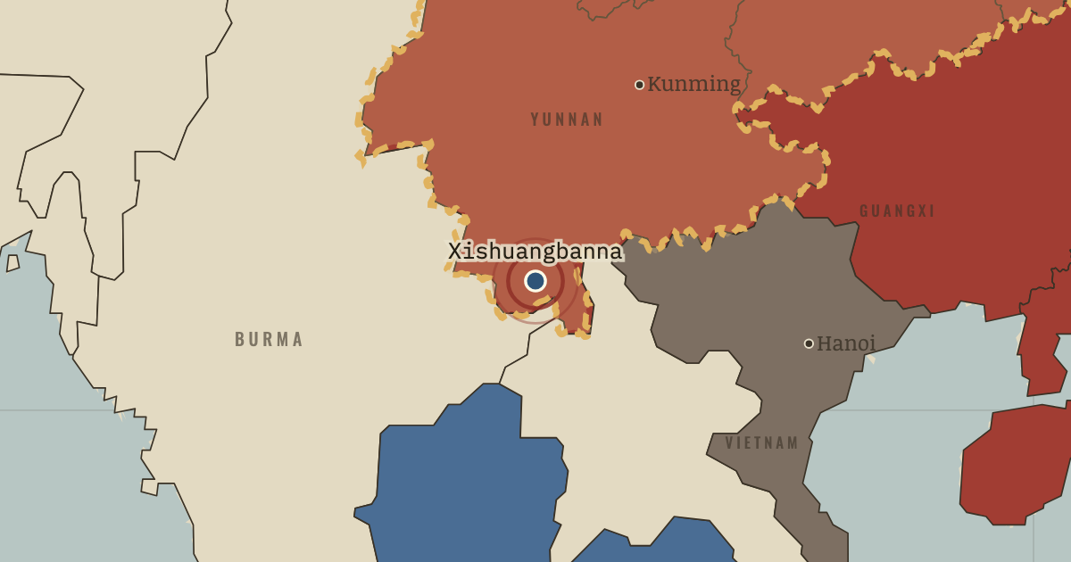
On the Mao’s China map as “Xishuangbanna”
1969–79 — On army-run state farms in southern Yunnan, tens of thousands of sent-down youth from Shanghai, Beijing and Chongqing clear rainforest to grow rubber. Hunger, hard labor and abuse by cadres bring strikes and a petition to Beijing in 1978–79. Most are then allowed to return home.
When 1969–79 Type Turning point Chapter Down to the Countryside Movement (chapter 10 of Mao’s China)Atlas The People’s Republic under Mao, 1949–1976 TURNING POINT · THE PEOPLE’S REPUBLIC UNDER MAO, 1949–1976 These maps are reconstructed from published sources · US Office of the Historian — Sino-Soviet border clashes, 1969 · Cliopatria v0.2.1 — dated political boundaries · United Nations Command — 1951–1953 armistice negotiations · Natural Earth — physical reference geography · Natural Earth 10m — provincial study-region reference · Government of India — notes exchanged with China, White Paper VIII, 1962 · Natural Earth 10m island components; FRUS 1955 evacuation chronology · Barry Naughton — The Third Front: Defence Industrialization in the Chinese Interior, 1988 · Man Xu — regional scope of Third Front development, thesis figure 4-5
Source details US Office of the Historian — Sino-Soviet border clashes, 1969. Historical facts consulted; original prose and artwork not republished Cliopatria contributors / Seshat Global History Databank. CC BY4.0 · Dated polity and constituent territory selections; campaign-dependent occupation overlays reconstructed separately. United Nations Command — 1951–1953 armistice negotiations. Historical facts consulted; original prose and artwork not republished Natural Earth. Public domain Natural Earth 10m — provincial study-region reference. Public domain Government of India — notes exchanged with China, White Paper VIII, 1962. Historical facts consulted; original prose and artwork not republished Natural Earth 10m island components; FRUS 1955 evacuation chronology. Natural Earth public domain; historical facts consulted Barry Naughton — The Third Front: Defence Industrialization in the Chinese Interior, 1988. Historical facts consulted; original prose and artwork not republished Man Xu — regional scope of Third Front development, thesis figure 4-5. Historical facts consulted; original prose and artwork not republished Provincial colors show standardized Natural Earth study regions, with Hainan included in Guangdong and Chongqing in Sichuan. External boundaries follow dated historical sources; the map does not claim to show changes in internal provincial administrations.
proxy: 1964–1971 · proxy: 1971.75 · reconstruction: 1963 source boundary reference after withdrawal · reconstruction: 1971.75 · vector: 1953-07-27 · vector: 1971.75
Layer records and reconstruction methods
In the same chapter
Related
THE FREE PRINTABLE STUDY GUIDE
Get the printable study guide for The People’s Republic under Mao free. I’ll send you a few short letters, then one when a new atlas opens. That’s all. — Paul
NO TRACKING · YOUR ADDRESS IS USED FOR THE DISPATCH AND NOTHING ELSE ·
UNSUBSCRIBE ANYTIME