MAPS OF HISTORY · MAO’S CHINA · BATTLES AND EVENTS · Xi Jinping at LiangjiaheMao’s China · TURNING POINT · 1969
Xi Jinping at Liangjiahe (1969)
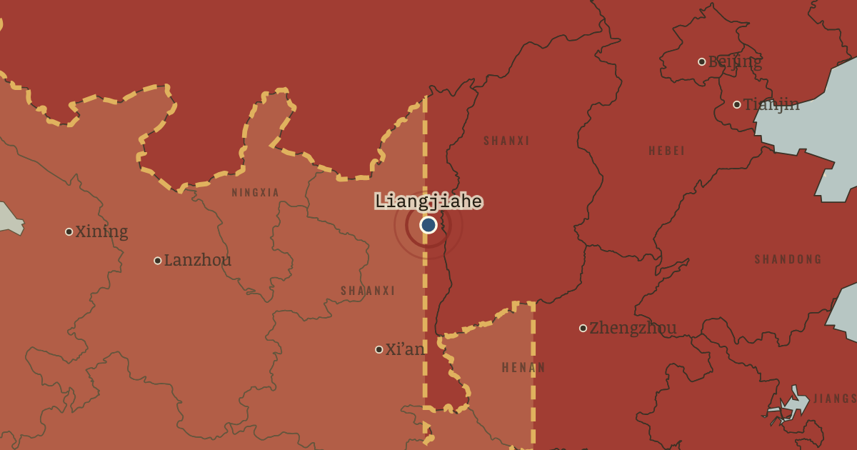
On the Mao’s China map as “Liangjiahe”
Jan 1969 — Xi Jinping arrives at Liangjiahe, a cave village in northern Shaanxi. He is fifteen, comes from Beijing, and is the son of a purged vice-premier. Among thousands of Beijing youths sent to the Yan’an region, he remains almost seven years. Rustication shaped the generation that would govern China half a century later.
When Jan 1969 Type Turning point Chapter Down to the Countryside Movement (chapter 10 of Mao’s China)Atlas The People’s Republic under Mao, 1949–1976 TURNING POINT · THE PEOPLE’S REPUBLIC UNDER MAO, 1949–1976 These maps are reconstructed from published sources · US Office of the Historian — Sino-Soviet border clashes, 1969 · Cliopatria v0.2.1 — dated political boundaries · United Nations Command — 1951–1953 armistice negotiations · Natural Earth — physical reference geography · Natural Earth 10m — provincial study-region reference · Government of India — notes exchanged with China, White Paper VIII, 1962 · Natural Earth 10m island components; FRUS 1955 evacuation chronology · Barry Naughton — The Third Front: Defence Industrialization in the Chinese Interior, 1988 · Man Xu — regional scope of Third Front development, thesis figure 4-5
Source details US Office of the Historian — Sino-Soviet border clashes, 1969. Historical facts consulted; original prose and artwork not republished Cliopatria contributors / Seshat Global History Databank. CC BY4.0 · Dated polity and constituent territory selections; campaign-dependent occupation overlays reconstructed separately. United Nations Command — 1951–1953 armistice negotiations. Historical facts consulted; original prose and artwork not republished Natural Earth. Public domain Natural Earth 10m — provincial study-region reference. Public domain Government of India — notes exchanged with China, White Paper VIII, 1962. Historical facts consulted; original prose and artwork not republished Natural Earth 10m island components; FRUS 1955 evacuation chronology. Natural Earth public domain; historical facts consulted Barry Naughton — The Third Front: Defence Industrialization in the Chinese Interior, 1988. Historical facts consulted; original prose and artwork not republished Man Xu — regional scope of Third Front development, thesis figure 4-5. Historical facts consulted; original prose and artwork not republished Provincial colors show standardized Natural Earth study regions, with Hainan included in Guangdong and Chongqing in Sichuan. External boundaries follow dated historical sources; the map does not claim to show changes in internal provincial administrations.
proxy: 1964–1971 · proxy: 1971.75 · reconstruction: 1963 source boundary reference after withdrawal · reconstruction: 1971.75 · vector: 1953-07-27 · vector: 1971.75
Layer records and reconstruction methods
In the same chapter
Related
THE FREE PRINTABLE STUDY GUIDE
Get the printable study guide for The People’s Republic under Mao free. I’ll send you a few short letters, then one when a new atlas opens. That’s all. — Paul
NO TRACKING · YOUR ADDRESS IS USED FOR THE DISPATCH AND NOTHING ELSE ·
UNSUBSCRIBE ANYTIME