MAPS OF HISTORY · INDIAN INDEPENDENCE · BATTLES AND EVENTS · Noakhali riotsIndian independence · SITE OF MEMORY · 1946
Noakhali riots (1946)
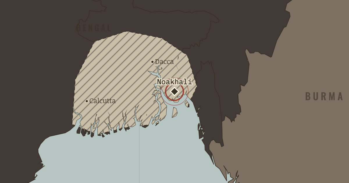
On the Indian independence map as “Noakhali”
Oct–Nov 1946 — Organized attacks on the Hindu minority in the Noakhali delta included killings, forced conversions, and abductions. Gandhi, aged 77, walked barefoot from village to village in the district for four months. Violence answered the attacks in Bihar. Remember them.
When Oct–Nov 1946 Type Site of memory Chapter Cabinet Mission and Direct Action Day (chapter 12 of Indian independence)Atlas Indian Independence & Partition, 1857–1964 SITE OF MEMORY · INDIAN INDEPENDENCE & PARTITION, 1857–1964 These maps are reconstructed from published sources · Cliopatria v0.2.1: dated historical polity records · National Archives of India: Abhilekh Patal historical records portal · Natural Earth v5.1.2: complete country reference geometry · Natural Earth: administrative reference units · Imperial Gazetteer of India (1908): Indian Empire political plate
Source details Cliopatria contributors / Seshat Global History Databank. CC BY 4.0 · Reviewed record selection; East/West Pakistan selected as complete components; source dates and identities retained. National Archives of India; contextual historical records, not a boundary survey. Historical factual reference; no source prose reproduced Natural Earth. Public domain Natural Earth. Public domain · Full components retained and dissolved into explicitly dated historical groups; no source-coordinate simplification. J. G. Bartholomew / Imperial Gazetteer of India, 1908; scan Fowler & Fowler. Public domain · Native-resolution colour-boundary extraction; printed graticule registration; printed label holes removed, territorial enclaves retained. 1908 geography is explicitly a nearby-date proxy in earlier chapters. Princely-state geography follows the published 1908 plate. Earlier chapters use it explicitly as a nearby-date reference, rather than reconstructing local state transfers as exact dated surveys.
The treaty/paramountcy patchwork provides a political reference. Hatches for famine, violence and rebellion locate affected reporting regions rather than areas of uniform territorial possession.
proxy: Contemporary regional reference · proxy: Historical enclave, source-vintage outline · proxy: Modern same-enclave reference · proxy: Natural Earth v5.1.2 · reconstruction: 1908 printed patchwork with coastal registration · reconstruction: Event-specific regional reporting units; source-vintage geography · vector: 1890–2023 · vector: 1939–1946 · vector: 1943–1946 · vector: 1944–1946 · vector: 1946–1946
Layer records and reconstruction methods
In the same chapter
Related
THE FREE PRINTABLE STUDY GUIDE
Get the printable study guide for Indian Independence & Partition free. I’ll send you a few short letters, then one when a new atlas opens. That’s all. — Paul
NO TRACKING · YOUR ADDRESS IS USED FOR THE DISPATCH AND NOTHING ELSE ·
UNSUBSCRIBE ANYTIME