The Road to War, 1931–1941 · THE MAP IN
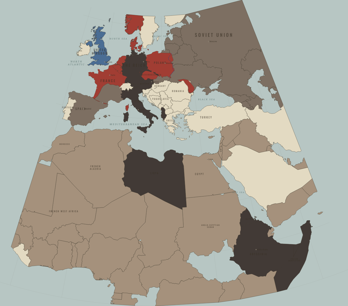
Map of Europe and Africa in June 1940
The West falls · road to WW2
Europe and Africa in June 1940: The West falls. Since September 1939, 9 territories changed status on this map: including Denmark, Norway, Belgium and 6 more.
Open this map in the interactive atlas →
WW2 is free in full, and chapter 1 of every atlas is free. A free account opens 3 more chapters a day. Starter, at $9 a month, opens all 21 with no daily limit — see the plans.
What changes on the map
| Denmark | Neutral & unaligned → Occupied — held by force |
| Norway | Neutral & unaligned → Occupied — held by force |
| Belgium | Neutral & unaligned → Occupied — held by force |
| Netherlands | Neutral & unaligned → Occupied — held by force |
| Luxembourg | Neutral & unaligned → Occupied — held by force |
| France | Democracies & powers fighting them → Occupied — held by force |
| Estonia | Neutral & unaligned → Aggressor clients & partners |
| Latvia | Neutral & unaligned → Aggressor clients & partners |
| Lithuania | Neutral & unaligned → Aggressor clients & partners |
On the ground
- From June 1940, Germany occupied northern France, including Paris, and the Atlantic coast.
- The unoccupied “Free Zone” was governed from Vichy as a collaborating client, not a conquest.
- In June 1940, the USSR seized Bessarabia and northern Bukovina from Romania.
The chapters of this moment
Related maps
THE FREE PRINTABLE STUDY GUIDE
Get the printable study guide for The Road to War free. I’ll send you a few short letters, then one when a new atlas opens. That’s all. — Paul
NO TRACKING · YOUR ADDRESS IS USED FOR THE DISPATCH AND NOTHING ELSE · UNSUBSCRIBE ANYTIME