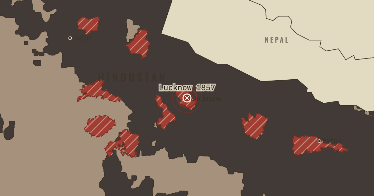
30 Jun – 22 Nov 1857 — For almost five months, about 1,700 defenders held the Residency with 1,280 non-combatants; 712 of the defenders were loyal sepoys. Meanwhile Begum Hazrat Mahal governed Awadh in her young son’s name. Campbell evacuated the Residency in November, but Lucknow did not fall until March 1858.
WW2 is free in full, and chapter 1 of every atlas is free. A free account opens 3 more chapters a day. Starter, at $9 a month, opens all 21 with no daily limit — see the plans.
22 NOVEMBER 1857 · INDIAN INDEPENDENCE & PARTITION, 1857–1964
The moment in context
The hatched lands on the January 1857 map show where recent Company expansion had disturbed established interests. Lord Dalhousie, the Governor-General and the Company's chief executive in India, had taken Satara, Jhansi and Nagpur under the Doctrine of Lapse. When a dependent ruler died without a natural son, the Company claimed his state even if he had adopted an heir. In 1856 Dalhousie also annexed Awadh (Oudh). There new revenue settlements assessed village ownership and tax obligations, depriving great landholders, the talukdars, of villages their families had held for generations. Many Bengal Army sepoys came from Awadh, so a change in government reached into the families of the Company's own soldiers. Their standing was threatened in another way: caste, the inherited rank governing whom a Hindu could marry or eat with, made overseas service dangerous to their place at home. Cartridges said to contain the fat of cows sacred to Hindus or pigs forbidden to Muslims raised fears of religious pollution.
From Indian Rebellion of 1857, chapter 1 of Indian Independence & Partition, 1857–1964 (JUL 1857).
Why it happened — Dalhousie’s annexations and the Doctrine of Lapse. Between 1848 and 1856 Dalhousie added more territory to British India than any previous governor. Some came by conquest: Punjab in 1849 and Lower…
The turn — Delhi, 11 May 1857. The Meerut troopers arrived at Delhi on 11 May 1857 and persuaded the reluctant Bahadur Shah Zafar, then eighty-one, to accept their allegiance.…
What it changed — The Crown replaces the Company. The Government of India Act of 2 August 1858 transferred authority from the Company to the Crown. In London a Secretary of State and his council…
Get the printable study guide for Indian Independence & Partition free. I’ll send you a few short letters, then one when a new atlas opens. That’s all. — Paul
NO TRACKING · YOUR ADDRESS IS USED FOR THE DISPATCH AND NOTHING ELSE ·
UNSUBSCRIBE ANYTIME