MAPS OF HISTORY · COUNTRIES · São Tomé and Príncipe5 ATLASES
History of São Tomé and Príncipe in maps
São Tomé and Príncipe as it appears in 5 interactive history atlases, from 1945 to 2015: São Tomé and Príncipe. Each era below lists who ruled the land and when control changed, linked to the dated map that shows it.
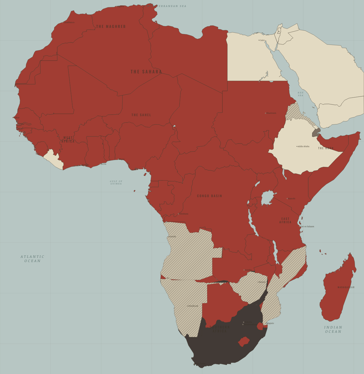
MAP OF AFRICA IN 1975 These maps are reconstructed from published sources · US Foreign Relations: Southern Africa, 1969–1976 · Cliopatria v0.2.1: reviewed historical components · UN General Assembly: Eritrea federation, 11 September 1952 · Natural Earth v5.1.2: 1:10m countries · UN Transition Assistance Group: Namibia independence · UN: former Trust and Non-Self-Governing Territories · UN: Western Sahara remains a Non-Self-Governing Territory
Source details US Department of State; published diplomatic records. Historical factual evidence; text and images not reproduced Cliopatria contributors / Seshat Global History Databank. CC BY 4.0 · Explicit record/component selection; documented nearby-date proxies, intersections and unions. Known compound-name and end-date errors excluded. UN General Assembly resolution 617 (VII). Historical factual evidence; text and images not reproduced Natural Earth. Public domain · Full source coordinates retained; African extraction; Egypt self-touching ring repaired with negligible area delta; explicit historical unions. United Nations Peacekeeping. Historical factual evidence; text and images not reproduced United Nations; territorial successions and independence dates. Historical factual evidence; text and images not reproduced United Nations; no independent-sovereignty claim. Historical factual evidence; text and images not reproduced The maps are reconstructed from published sources. Explicit records provide historical unions and changed colonial units; inherited outer boundaries use the closest reusable reference from the source vintage.
War hatches mark affected administrative reporting regions. They do not trace exact fronts or the extent of controlled territory. Each layer records its source selection and boundary dates.
This inherited snapshot summarises the labelled year or interval. Its nominal slider date does not mean that every independence or conflict listed had already occurred on that day.
Western Sahara is shown as disputed, following the UN status record, rather than as an independently sovereign state. This corrects the inherited map classification while leaving the chapter text unchanged.
The eastern-edge Israeli polygons show published control extents, including occupied territory, rather than sovereign claims. The source covering 1976–82 does not resolve each stage of the Sinai withdrawal.
proxy: Country/territory reference; conflict dates follow the chapter · proxy: Natural Earth v5.1.2 contemporary reference · reconstruction: 1945–1994; contemporary source perimeter · reconstruction: 1952–1993; contemporary source perimeter · reconstruction: 1960–1994; contemporary source perimeter · vector: 1936–1986; used through 1985 · vector: 1958–1959 Spanish Sahara extent; reused for the disputed territory after 1975 · vector: 1963–1975 source; nearby-date exterior reference for 1945–1994 · vector: 1969–1975; reused after 1975 · vector: 1969–1986; reused as pre-unification geographic proxy · vector: 1973–1975
Layer records and reconstruction methods
What was São Tomé and Príncipe before it was São Tomé and Príncipe? The sections below follow this
land through every era covered by the Maps of History atlases: who ruled it, what it was
called, and when control changed. Each line links to the dated map. Modern borders serve
as an approximation, as each atlas says on the map itself.
São Tomé and Príncipe · Industrial Revolution
INDUSTRIAL REVOLUTION: EVERY CHAPTER AND MAP →
São Tomé and Príncipe · WWI
WWI: EVERY CHAPTER AND MAP →
São Tomé and Príncipe · Cold War
COLD WAR: EVERY CHAPTER AND MAP →
São Tomé and Príncipe · Decolonization of Africa
1945 Portuguese, Belgian, Spanish & Italian-ruled — the opening position 1975 Independent Africa
DECOLONIZATION OF AFRICA: EVERY CHAPTER AND MAP →
São Tomé and Príncipe · Feminism and the Tunisian Revolution
1945 Authoritarian, one-party or colonial rule — the opening position MAY 1970 No reform yet / outside this story
FEMINISM AND THE TUNISIAN REVOLUTION: EVERY CHAPTER AND MAP →
Related
THE FREE PRINTABLE STUDY GUIDE
Get a printable atlas study guide of your choice free. I’ll send you a few short letters, then one when a new atlas opens. That’s all. — Paul
NO TRACKING · YOUR ADDRESS IS USED FOR THE DISPATCH AND NOTHING ELSE ·
UNSUBSCRIBE ANYTIME