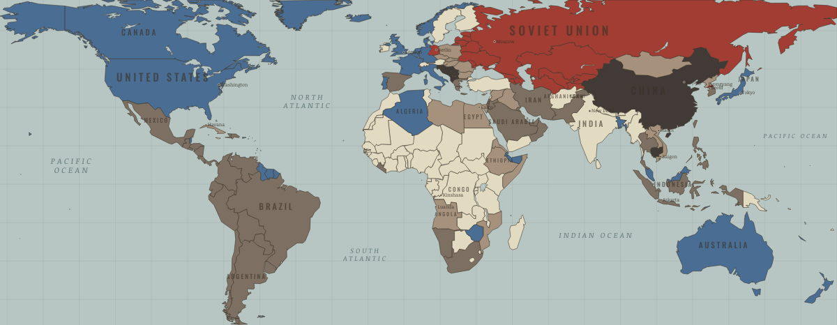
Angola as it appears in 5 interactive history atlases, from 1890 to 2015: Angola. Each era below lists who ruled the land and when control changed, linked to the dated map that shows it.
WW2 is free in full, and chapter 1 of every atlas is free. A free account opens 3 more chapters a day. Starter, at $9 a month, opens all 21 with no daily limit — see the plans.
What was Angola before it was Angola? The sections below follow this
land through every era covered by the Maps of History atlases: who ruled it, what it was
called, and when control changed. Each line links to the dated map. Modern borders serve
as an approximation, as each atlas says on the map itself.
After Portugal abandoned its colony, Angola became a main stage for proxy war. Cuban regulars, South African columns, and CIA cash had arrived before independence day in 1975 (Ch. 8). The civil war that Cold War powers armed lasted twenty-seven years, continuing a decade beyond their patrons’ interest. Oil and diamonds paid for everyone’s ammunition.
Angola fought Portugal from 1961 and entered an internationalized civil war at independence in November 1975. The MPLA received Cuban troops and Soviet arms; UNITA and the FNLA had South African columns and CIA money. Oil and diamonds funded fighting that continued for twenty-seven years. Here the war of liberation passed directly into a Cold War proxy war, the clearest such case on the map.
Portuguese, Belgian, Spanish & Italian-ruled — the opening position