The Russian Revolution, 1855–1924 · THE MAP IN
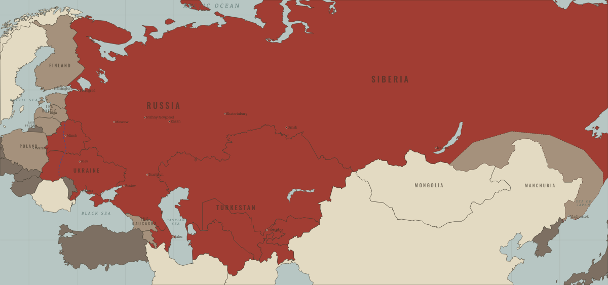
Map of Russia in November 1920
The Crimea evacuated · Russian Civil War
Russia in November 1920: The Crimea evacuated. The map shows who held what: Soviet power, Foreign powers & intervention, Breakaway national states.
Open this map in the interactive atlas →
WW2 is free in full, and chapter 1 of every atlas is free. A free account opens 3 more chapters a day. Starter, at $9 a month, opens all 21 with no daily limit — see the plans.
Free printable Russian Revolution study guide, sent by email ↓
Related maps
THE FREE PRINTABLE STUDY GUIDE
Get the printable study guide for The Russian Revolution free. I’ll send you a few short letters, then one when a new atlas opens. That’s all. — Paul
NO TRACKING · YOUR ADDRESS IS USED FOR THE DISPATCH AND NOTHING ELSE · UNSUBSCRIBE ANYTIME