MAPS OF HISTORY · RUSSIAN REVOLUTION · BATTLES AND EVENTS · Kolchak’s Omsk governmentRussian Revolution · TURNING POINT · 1918
Kolchak’s Omsk government (1918)
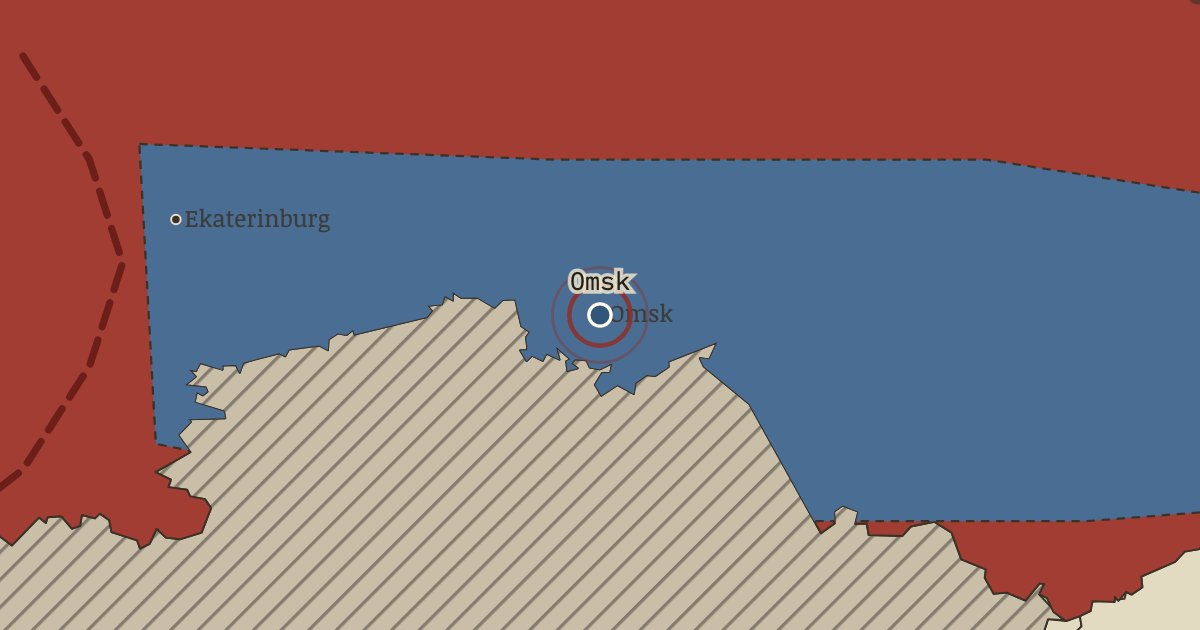
On the Russian Revolution map as “Omsk: Kolchak’s capital”
Nov 1918 — A coup makes Admiral Kolchak “Supreme Ruler” of all the Whites, with his government at Omsk. The title gives him authority on paper, but much less on the ground. His capital lies 5,000 km from the sea controlled by his allies.
When Nov 1918 Type Turning point Chapter Why the Reds won the Russian Civil War (chapter 9 of Russian Revolution)Atlas The Russian Revolution, 1855–1924 TURNING POINT · THE RUSSIAN REVOLUTION, 1855–1924 These maps are reconstructed from published sources · Cliopatria v0.2.1 — dated political boundaries · Library of Congress — Russian Civil War campaign map 03 (1920s original) · Library of Congress — Russian Civil War campaign map 04 (1920s original) · Library of Congress — Russian Civil War campaign map 05 (1920s original) · Library of Congress — Russian Civil War campaign map 06 (1920s original) · Library of Congress — Russian Civil War campaign map 07 (1920s original) · Library of Congress — Russian Civil War campaign map 08 (1920s original)
Source details Cliopatria contributors / Seshat Global History Databank. CC BY4.0 · Dated polity and constituent territory selections; campaign-dependent occupation overlays reconstructed separately. A. N. de-Lazari, N. N. Lesevitskii and collaborators; Gosizdat, RSFSR. Historical geographic facts independently reconstructed; original artwork not republished A. N. de-Lazari, N. N. Lesevitskii and collaborators; Gosizdat, RSFSR. Historical geographic facts independently reconstructed; original artwork not republished A. N. de-Lazari, N. N. Lesevitskii and collaborators; Gosizdat, RSFSR. Historical geographic facts independently reconstructed; original artwork not republished A. N. de-Lazari, N. N. Lesevitskii and collaborators; Gosizdat, RSFSR. Historical geographic facts independently reconstructed; original artwork not republished A. N. de-Lazari, N. N. Lesevitskii and collaborators; Gosizdat, RSFSR. Historical geographic facts independently reconstructed; original artwork not republished A. N. de-Lazari, N. N. Lesevitskii and collaborators; Gosizdat, RSFSR. Historical geographic facts independently reconstructed; original artwork not republished Unassigned civil-war gaps in the annual vector source are rebuilt within the prewar imperial outline, excluding dated neighbouring states. Campaign maps determine Red and White control.
Civil-war lines show the published campaign phase. Port, railway and uprising footprints represent thematic military-presence regions; their stated widths do not claim surveyed political frontiers.
reconstruction: 1919.45 · reconstruction: 30 June 1919 · reconstruction: Late June 1919 · vector: 1919.45
Layer records and reconstruction methods
In the same chapter
Related
THE FREE PRINTABLE STUDY GUIDE
Get the printable study guide for The Russian Revolution free. I’ll send you a few short letters, then one when a new atlas opens. That’s all. — Paul
NO TRACKING · YOUR ADDRESS IS USED FOR THE DISPATCH AND NOTHING ELSE ·
UNSUBSCRIBE ANYTIME