MAPS OF HISTORY · RUSSIAN REVOLUTION · BATTLES AND EVENTS · Allied landing at MurmanskRussian Revolution · TURNING POINT · 1918
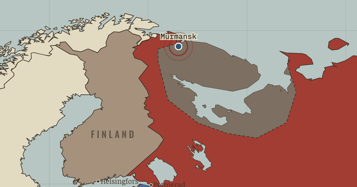
Allied landing at Murmansk (1918)
On the Russian Revolution map as “Murmansk”
Mar 1918 — The local soviet invites the first Allied landing to protect war stores from the Germans. The intervention later turns against the Bolsheviks. Its confused beginning was far removed from a straightforward conquest.
When Mar 1918 Type Turning point Chapter Allied intervention in Russia (chapter 10 of Russian Revolution)Atlas The Russian Revolution, 1855–1924 TURNING POINT · THE RUSSIAN REVOLUTION, 1855–1924 These maps are reconstructed from published sources · Cliopatria v0.2.1 — dated political boundaries · Library of Congress — Russian Civil War campaign map 03 (1920s original) · Library of Congress — Russian Civil War campaign map 04 (1920s original) · Library of Congress — Russian Civil War campaign map 06 (1920s original) · Library of Congress — Russian Civil War campaign map 07 (1920s original) · Library of Congress — Russian Civil War campaign map 08 (1920s original)
Source details Cliopatria contributors / Seshat Global History Databank. CC BY4.0 · Dated polity and constituent territory selections; campaign-dependent occupation overlays reconstructed separately. A. N. de-Lazari, N. N. Lesevitskii and collaborators; Gosizdat, RSFSR. Historical geographic facts independently reconstructed; original artwork not republished A. N. de-Lazari, N. N. Lesevitskii and collaborators; Gosizdat, RSFSR. Historical geographic facts independently reconstructed; original artwork not republished A. N. de-Lazari, N. N. Lesevitskii and collaborators; Gosizdat, RSFSR. Historical geographic facts independently reconstructed; original artwork not republished A. N. de-Lazari, N. N. Lesevitskii and collaborators; Gosizdat, RSFSR. Historical geographic facts independently reconstructed; original artwork not republished A. N. de-Lazari, N. N. Lesevitskii and collaborators; Gosizdat, RSFSR. Historical geographic facts independently reconstructed; original artwork not republished Unassigned civil-war gaps in the annual vector source are rebuilt within the prewar imperial outline, excluding dated neighbouring states. Campaign maps determine Red and White control.
Civil-war lines show the published campaign phase. Port, railway and uprising footprints represent thematic military-presence regions; their stated widths do not claim surveyed political frontiers.
The southern front shows the mid-October maximum toward Orel, while eastern control follows the October campaign map. Allied northern intervention has ended.
reconstruction: 1919.78 · trace: Mid-October 1919 · trace: October 1919 · vector: 1919.78
Layer records and reconstruction methods
In the same chapter
Related
THE FREE PRINTABLE STUDY GUIDE
Get the printable study guide for The Russian Revolution free. I’ll send you a few short letters, then one when a new atlas opens. That’s all. — Paul
NO TRACKING · YOUR ADDRESS IS USED FOR THE DISPATCH AND NOTHING ELSE ·
UNSUBSCRIBE ANYTIME