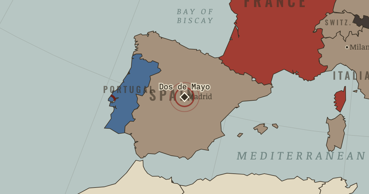
MAPS OF HISTORY · AGE OF REVOLUTIONS · BATTLES AND EVENTS · Dos de Mayo UprisingAge of Revolutions · SITE OF MEMORY · 1808
Dos de Mayo Uprising (1808)
On the Age of Revolutions map as “The Dos de Mayo”
2–3 May 1808 — Madrid rose against the French occupation. The reprisals were severe: hundreds were executed. Goya later painted the firing squads, showing war stripped of its glory.
When 2–3 May 1808 Type Site of memory Chapter Peninsular War (chapter 7 of Age of Revolutions)Atlas The Age of Revolutions, 1775–1848 SITE OF MEMORY · THE AGE OF REVOLUTIONS, 1775–1848 These maps are reconstructed from published sources · Cliopatria v 0.2.1 · Government of Slovenia: The Illyrian Provinces 1809–1813 · Natural Earth physical geography · Maps of History: Revolutions reconstruction decisions · Treaty between Prussia and France, Tilsit,9 July 1807 · Historic Route of the Lines of Torres Vedras · Fondation Napoléon: The Duchy of Warsaw
Source details Cliopatria contributors / Seshat Global History Databank. Selected, combined, reprojected and corrected by Maps of History as described per layer.. CC BY4.0 Government of Slovenia, Sinfo 5/2009: listed provinces and territorial changes.. Historical evidence citation; no scan geometry copied Made with Natural Earth; present coastlines support physical clipping, not historical political boundaries.. Public domain Maps of History: regional revolt/campaign footprints are inferred teaching regions, not surveyed fronts or homogeneous control.. Original educational reconstruction using cited datasets and historical evidence Treaty of Tilsit articles II, VII–XV: restored Prussian territories, cessions and Duchy of Warsaw.. Historical treaty evidence; no modern map copied Rota Histórica das Linhas de Torres; Sizandro–Torres Vedras–Sobral–Alhandra defensive system.. Historical evidence citation; reconstructed line, no map copied Fondation Napoléon;1807 foundation and 1809 territorial enlargement.. Historical evidence citation; no map copied Annual source outlines can combine imperial claims with areas of control. The labels identify the historical role selected, while dates finer than the source interval are made explicit in these details.
Source political names are checked against military-control extents. Record 10792 is treated as continental Prussia, and temporary French campaign extensions are distinguished from treaty-state territory.
Displayed map state e 10 at 1810.45; chapter framing 1810.45. Where finer geometry is unavailable, monthly states use annual source references.
proxy: 1812–1813 enlarged source for 1810–1812 · reconstruction: 1810.45 · vector: 1721–1813 · vector: 1769–1841 · vector: 1772–1810 · vector: 1775–1810 · vector: 1788–1810 · vector: 1792–1829 · vector: 1796–1829 · vector: 1796–1835 · vector: 1800–1813 · vector: 1800–1814 · vector: 1800–1819 · vector: 1800–1821 · vector: 1803–1810 · vector: 1803–1889 · vector: 1805–1810 · vector: 1805–1813 · vector: 1805–1819 · vector: 1806–1810 · vector: 1806–1813 · vector: 1807–1810 · vector: 1807–1813 · vector: 1809–1810 · vector: 1809–1811 · vector: 1809–1813 · vector: 1809–1821
Layer records and reconstruction methods
In the same chapter
Related
THE FREE PRINTABLE STUDY GUIDE
Get the printable study guide for The Age of Revolutions free. I’ll send you a few short letters, then one when a new atlas opens. That’s all. — Paul
NO TRACKING · YOUR ADDRESS IS USED FOR THE DISPATCH AND NOTHING ELSE ·
UNSUBSCRIBE ANYTIME