Indian Independence & Partition, 1857–1964 · THE MAP IN
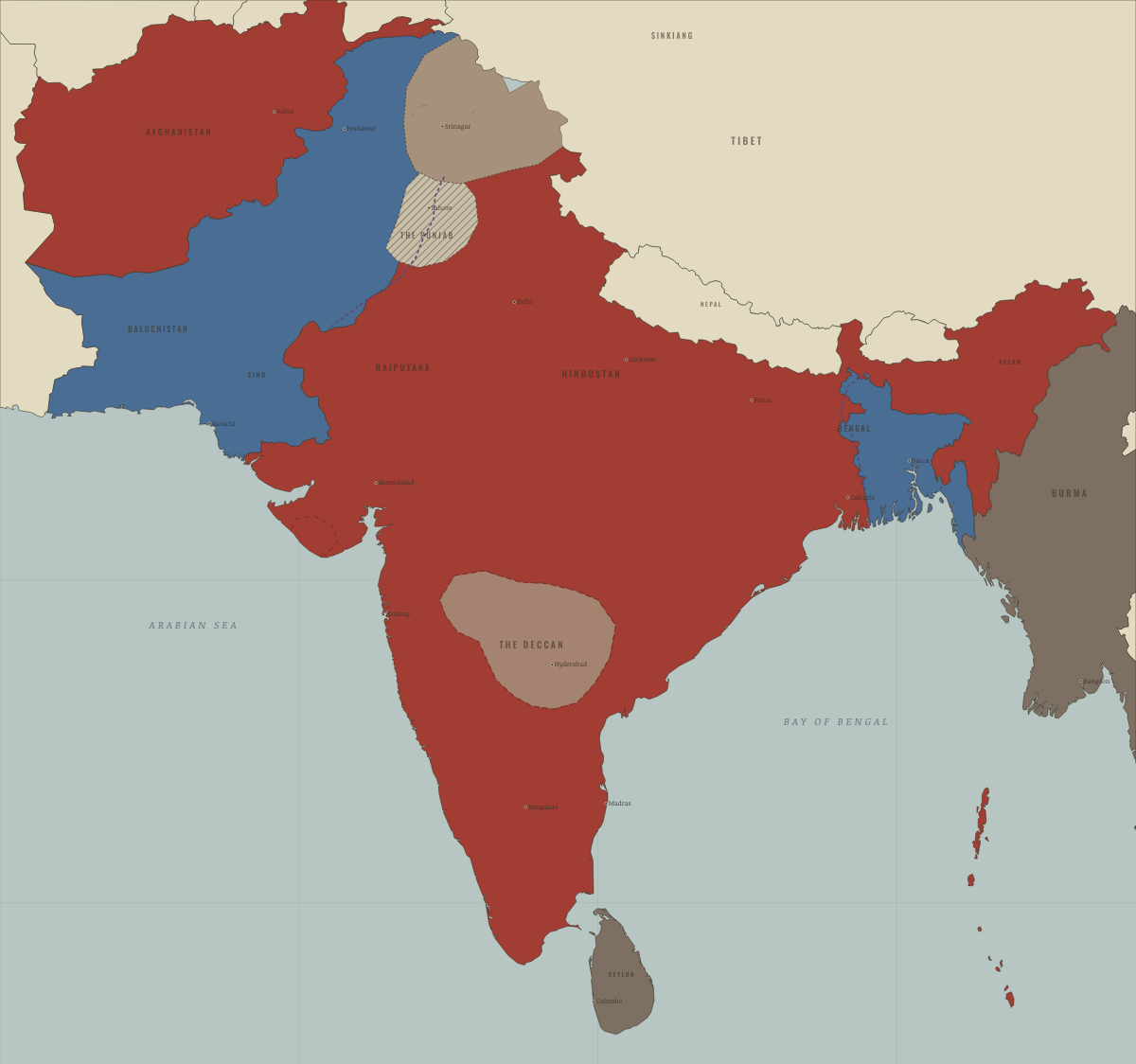
Map of India in August 1947
Partition — two dominions
India in August 1947: Partition — two dominions. Since March 1947, 4 territories changed status on this map: including India (the British Raj to 1947; the Republic from 1950), West Pakistan (the Raj’s west, to 1947), East Bengal / East Pakistan (mod. Bangladesh) and 1 more.
WW2 is free in full, and chapter 1 of every atlas is free. A free account opens 3 more chapters a day. Starter, at $9 a month, opens all 21 with no daily limit — see the plans.
Free printable Indian independence study guide, sent by email ↓
What changes on the map
| India (the British Raj to 1947; the Republic from 1950) | British India — direct rule → Self-rule / independent |
| West Pakistan (the Raj’s west, to 1947) | British India — direct rule → Pakistan (from Aug 1947) |
| East Bengal / East Pakistan (mod. Bangladesh) | British India — direct rule → Pakistan (from Aug 1947) |
| Siachen (part of Jammu & Kashmir) | British India — direct rule → Self-rule / independent |
On the ground
- Junagadh, 1947 — its Muslim nawab acceded the Hindu-majority state to Pakistan; India blockaded it
- Hyderabad, 1947–48 — the Nizam stood apart until Indian troops ended the standoff in five days
The chapters of this moment
Related maps
THE FREE PRINTABLE STUDY GUIDE
Get the printable study guide for Indian Independence & Partition free. I’ll send you a few short letters, then one when a new atlas opens. That’s all. — Paul
NO TRACKING · YOUR ADDRESS IS USED FOR THE DISPATCH AND NOTHING ELSE · UNSUBSCRIBE ANYTIME