MAPS OF HISTORY · HAITI AND KENYA INDEPENDENCE · BATTLES AND EVENTS · Kisumu massacreHaiti and Kenya independence · SITE OF MEMORY · 1969
Kisumu massacre (1969)
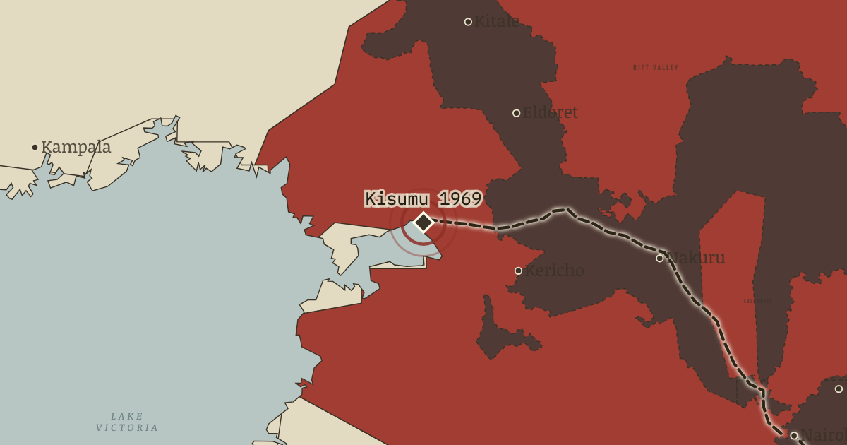
On the Haiti and Kenya independence map as “Kisumu, October 1969”
25 Oct 1969 — Hostile crowds greet Kenyatta on a visit to Odinga’s home town. His guards open fire, killing at least eleven people. Five days later the opposition KPU is banned. Remember them.
When 25 Oct 1969 Type Site of memory Chapter Kenya after independence (chapter 11 of Haiti and Kenya independence)Atlas Two Roads to Independence: Haiti 1789–1838 and Kenya 1895–1978 SITE OF MEMORY · TWO ROADS TO INDEPENDENCE: HAITI 1789–1838 AND KENYA 1895–1978 These maps are reconstructed from published sources · Cliopatria v0.2.1 — dated political boundaries · Kenya Interim Independent Boundaries Review Commission (2010), historical boundary maps 1–8 · Kenya Independence Order in Council 1963, Schedule 11 — districts and regions · Kenya Land Commission report (1933), foldout: European Highlands, reserves and railways · Natural Earth 10m — complete Kenyan province geometry · Science Museum Group — Kenya and Uganda Railways
Source details Cliopatria contributors / Seshat Global History Databank. CC BY4.0 · Dated polity and constituent territory selections; campaign-dependent occupation overlays reconstructed separately. Kenya Interim Independent Boundaries Review Commission (2010), historical boundary maps 1–8. Official boundary facts consulted; independently reconstructed geography. Original scan not republished. Kenya Independence Order in Council 1963, Schedule 11 — districts and regions. UK legislation, Open Government Licence; factual regional definitions. Kenya Land Commission report (1933), foldout: European Highlands, reserves and railways. 1934 UK Crown publication; original map facts independently digitized. Original scan not republished. Natural Earth 10m — complete Kenyan province geometry. Public domain Science Museum Group — Kenya and Uganda Railways. Factual route and opening dates consulted Colonial boundaries follow dated published imperial outlines. The 1963 regions use complete later provincial geometry as the closest digital reference, checked against the original legal district membership.
The Shifta layer identifies the North-Eastern conflict region; it does not imply uniform rebel control over all the land inside it.
The Highlands, reserves and forests are thematic study regions reconstructed from the 1933 commission map. The Kinangop grouping is removed after redistribution. The retained fills are regional historical land references, not an inventory of individual farm ownership.
proxy: 1963 regions; complete later digital provincial reference · reconstruction: 1901 main line; acquired 1933 railway reference · reconstruction: 1933 source reference · vector: 1966
Layer records and reconstruction methods
In the same chapter
Related
THE FREE PRINTABLE STUDY GUIDE
Get the printable study guide for Two Roads to Independence free. I’ll send you a few short letters, then one when a new atlas opens. That’s all. — Paul
NO TRACKING · YOUR ADDRESS IS USED FOR THE DISPATCH AND NOTHING ELSE ·
UNSUBSCRIBE ANYTIME