MAPS OF HISTORY · WWI · BATTLES AND EVENTS · Convoy systemWWI · TURNING POINT · 1917
Convoy system (1917)
On the WWI map as “The convoy system”
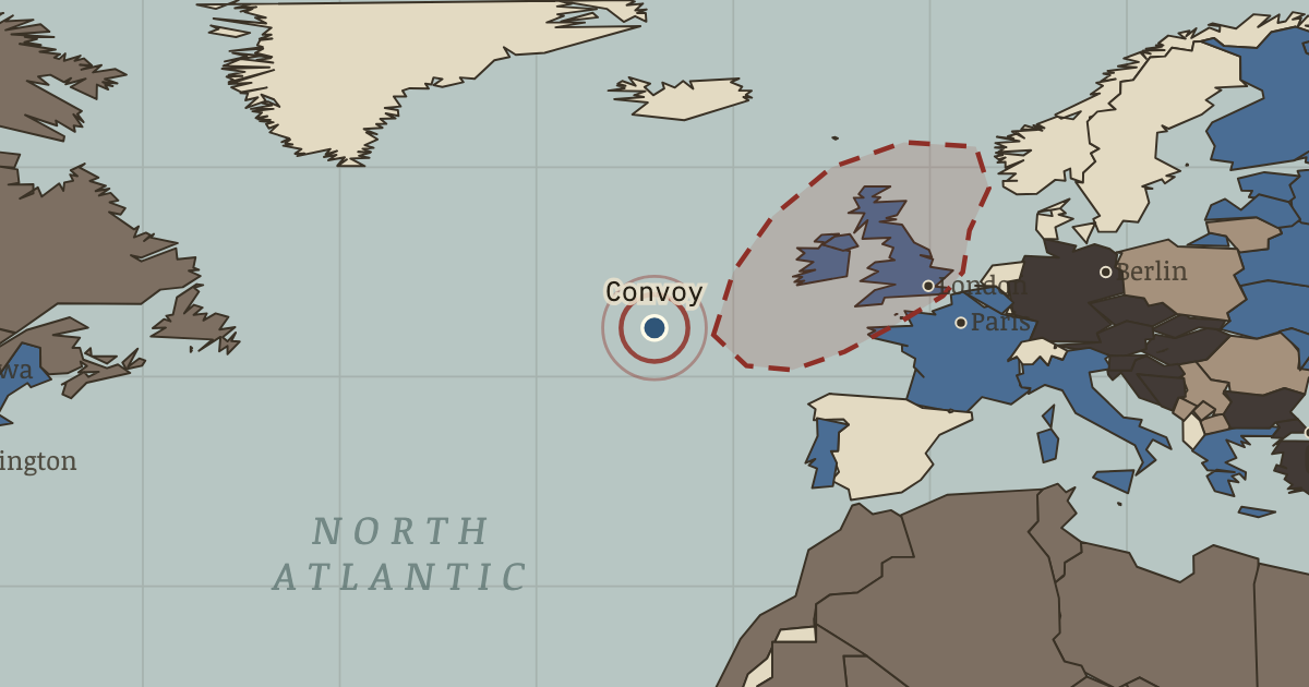
May 1917 — In April, 860,000 tons are sunk in a single month. The Admiralty responds by grouping merchant ships under escort. Losses collapse, and within six months the U-boat calculation that Germany could win before America reached the field has been destroyed.
When May 1917 Type Turning point Chapter Blockade and U-boat war in WWI (chapter 8 of WWI)Atlas The Great War, 1871–1923 TURNING POINT · THE GREAT WAR, 1871–1923 These maps are reconstructed from published sources · Cliopatria v 0.2.1 · Natural Earth physical geography · February 1917 shipping-zone amendments · German barred-zone declaration, February 1917
Source details Cliopatria contributors / Seshat Global History Databank. Source polygons retained with original identities; geographic selections and corrections by Maps of History.. CC BY 4.0 Made with Natural Earth; geographic reference and physical land only. No modern political boundary is used as a historical boundary.. Public domain Commercial and Financial Chronicle,10 February 1917, preserved by Federal Reserve Bank of St Louis.. Historical factual coordinate transcription; no scan redistributed US Naval Institute Proceedings, March 1917, German declaration transcribed; February 3 Dutch safety-strip correction described separately.. Published 1917 historical document; factual boundary coordinates transcribed Annual source features can describe claims, legal territory or military control. Occupied extensions are separated from the prewar Central Power homelands, while the original source names and shapes remain available.
The displayed state is isw 17. Geographic reference dates and reconstruction methods are recorded for each feature.
reconstruction: 1917 · reconstruction: February 1917 · vector: 1815–1937 · vector: 1840–1978 · vector: 1848–1935 · vector: 1864–1921 · vector: 1866–2023 · vector: 1877–1935 · vector: 1877–2023 · vector: 1885–1925 · vector: 1890–1978 · vector: 1890–2023 · vector: 1895–1917 · vector: 1895–1941 · vector: 1895–1978 · vector: 1898–2023 · vector: 1900–1918 · vector: 1900–1986 · vector: 1905–1921 · vector: 1905–1923 · vector: 1905–1925 · vector: 1905–1927 · vector: 1905–1928 · vector: 1905–1942 · vector: 1905–1949 · vector: 1905–1999 · vector: 1908–1931 · vector: 1908–1935 · vector: 1911–1925 · vector: 1911–1929 · vector: 1912–1919 · vector: 1912–1921 · vector: 1912–1955 · vector: 1913–1918 · vector: 1913–1919 · vector: 1914–1938 · vector: 1915–1918 · vector: 1915–1921 · vector: 1915–1940 · vector: 1916–1917 · vector: 1916–1918 · vector: 1916–1919 · vector: 1917–1917 · vector: 1917–1919 · vector: 1917–1921
Layer records and reconstruction methods
In the same chapter
Related
THE FREE PRINTABLE STUDY GUIDE
Get the printable study guide for WWI free. I’ll send you a few short letters, then one when a new atlas opens. That’s all. — Paul
NO TRACKING · YOUR ADDRESS IS USED FOR THE DISPATCH AND NOTHING ELSE ·
UNSUBSCRIBE ANYTIME