ON THIS DAY ·
Mukden Incident
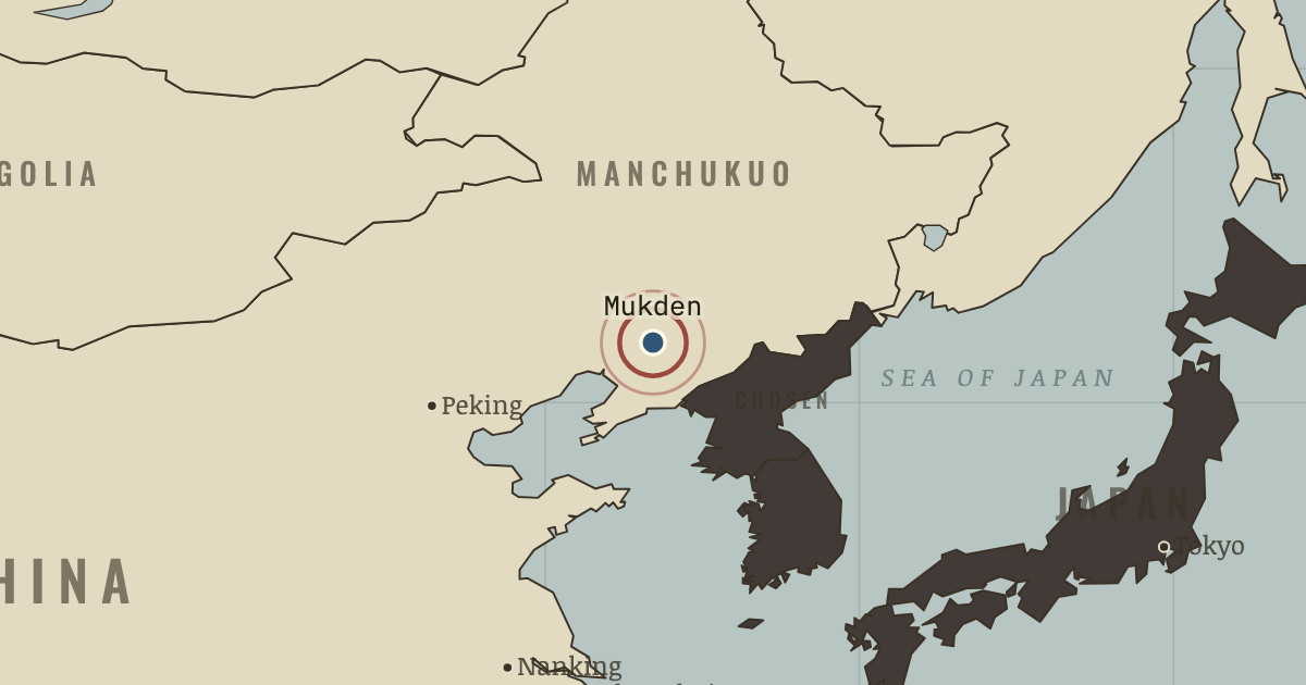
18 Sep 1931 — Officers of Japan’s Kwantung Army dynamite their own railway outside Mukden, then blame Chinese soldiers. Within months the army, acting apart from Japan’s government, has taken all of Manchuria.
WW2 is free in full, and chapter 1 of every atlas is free. A free account opens 3 more chapters a day. Starter, at $9 a month, opens all 21 with no daily limit — see the plans.
The moment in context
Before the Pacific map changes, Japan already possesses an empire. In two generations it has acquired Korea, Taiwan and islands across the Pacific. Those possessions have not made its economy self-sufficient: industry needs imported oil and metals, and exporters need customers abroad. Nearby lie the colonial territories of Britain, France, the Netherlands and the United States, including British Malaya and the oil-producing Dutch East Indies. China is nominally unified under Chiang Kai-shek, but warlords and a communist insurgency limit his government’s reach.
From Great Depression and causes of WW2, chapter 1 of The Road to War, 1931–1941 (1931).
The place: Mukden Incident — map and full story →
Teach this in 5 minutes
- Why it happened — The Depression and a closing world. World trade’s dollar value fell by roughly two-thirds between 1929 and 1933. Governments also raised barriers: the United States passed Smoot–Hawley…
- The turn — Mukden, the night of 18 September 1931. At the ✕ near Mukden, an explosion damaged the Manchurian railway only slightly on 18 September 1931. The Kwantung Army used it as a pretext for…
- What it changed — A pretext takes shape. In the summer of 1931, Kwantung Army staff officers Ishiwara and Itagaki prepared a railway incident, choosing where to place the explosive charge.…
Then ask the room: How far was the road to war laid by economics rather than ideology? The argued answer is on the chapter page →
The atlas that shows it
THE FREE PRINTABLE STUDY GUIDE
Get the printable study guide for The Road to War free. I’ll send you a few short letters, then one when a new atlas opens. That’s all. — Paul
NO TRACKING · YOUR ADDRESS IS USED FOR THE DISPATCH AND NOTHING ELSE · UNSUBSCRIBE ANYTIME