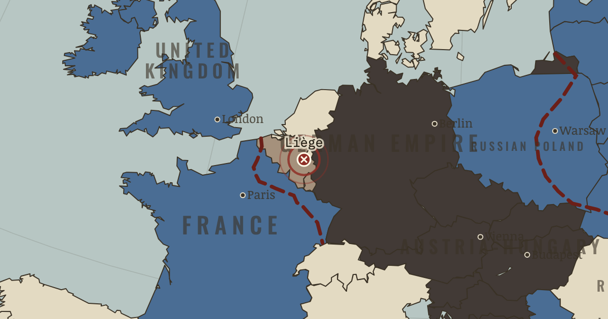
5-16 Aug 1914 — The Belgian ring fortress at Liège holds up the German right wing for ten days. Then 420mm siege howitzers, the largest guns yet fired in war, destroy the forts one by one. The delay damages the German timetable, but does not break it.
WW2 is free in full, and chapter 1 of every atlas is free. A free account opens 3 more chapters a day. Starter, at $9 a month, opens all 21 with no daily limit — see the plans.
The German arrows through Belgium represent an attempt to solve the problem of France and Russia together. Germany intended to defeat France during the weeks in which Russia was expected to assemble its larger army, then transfer forces east. The route through neutral Belgium made a wide sweep possible, but Belgian forts resisted and German violence against civilians supplied the Allies with a powerful propaganda cause.
Why it happened — The two-front arithmetic. The Franco-Russian alliance of 1894 joined two powers whose combined strength exceeded Germany's. Schlieffen's proposed answer depended on their…
The turn — The Marne, 5–12 September. A gap had opened between the German First and Second Armies. Lieutenant-Colonel Hentsch, sent forward to assess the position and coordinate a…
What it changed — The race to the sea — and the wall. After the Marne both sides tried to turn the other's northern flank, extending the fighting toward the sea. A fortified front came to run from the…