MAPS OF HISTORY · ON THIS DAY · MAY 20 · Battle of Crete: German airborne invasion (1941)ON THIS DAY · 20 MAY 1941
Battle of Crete: German airborne invasion
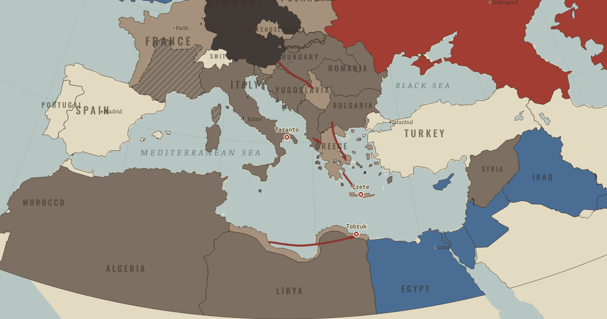
German paratroopers descend on Crete — the first invasion by air alone. It succeeds, at a price that ensures it is never tried again.
20 MAY 1941 · THE WAR ROOM — WW2, 1936–1945 These maps are reconstructed from published sources · Cliopatria v0.2.1 — dated political boundaries · French Ministry of the Armed Forces — La ligne de démarcation · Regional history institute — Italian annexations of1941, Fiume province and Krk · IGM Fiume, 1:25,000, sheet53B II SE — boundary established in1924 · Natural Earth — physical reference geography · Yugoslavia (1929–1939) location map — international frontier and Adriatic coast · Treaty of Rome (1924), division of Fiume and west-bank boundary · Murli / rowanwindwhistler — Slovakia border changes, 1938–1945 · United States Holocaust Memorial Museum — The Holocaust in Slovakia · Slovak Nation’s Memory Institute — The First Vienna Award
Source details Cliopatria contributors / Seshat Global History Databank. CC BY4.0 · Dated polity and constituent territory selections; campaign-dependent occupation overlays reconstructed separately. Ministère des Armées. Historical facts consulted; actual polygon imported from Cliopatria Regional history institute — Italian annexations of1941, Fiume province and Krk. Historical geographic facts consulted; source prose and artwork not republished Istituto Geografico Militare, Fiume (printed1946; 1927 survey with1931–1940 updates), reproduced by Istituto regionale per la storia della Resistenza e dell’Età contemporanea nel Friuli Venezia Giulia. Independent reconstruction from graticule coordinates and boundary observations; archive page reserves artwork rights.. Geographical-fact reconstruction; original archive artwork not distributed Natural Earth. Public domain NordNordWest/Wikipedia. Converted from the published SVG to WGS84; eastern Italian regional territory extracted. Source cites Velhagen & Klasings Großer Volksatlas (1938).. CC BY-SA 3.0 Germany 1924 agreement interpreted alongside the regional history institute and City of Rijeka’s explanation of the Donja/Gornja Drenova division.. Historical geographic facts; citation only Murli; SVG adaptation by rowanwindwhistler (2021). CC BY-SA 2.5; derived geographic paths under the same license · Georeferenced actual published vector regions using eight printed city positions; no map artwork or labels in the atlas. United States Holocaust Memorial Museum — The Holocaust in Slovakia. Historical chronology consulted; no source prose or artwork republished Slovak Nation’s Memory Institute — The First Vienna Award. Historical territorial chronology consulted; no source artwork or prose republished Slovak territory is reconstructed from the published 1938–1945 border-change map, which separates the client state from Hungarian and German annexations. This regional source does not resolve small northern frontier changes or survey-level detail. After August 1944, German military occupation supersedes the client-state fill.
The eastern Italian frontier uses the published 1930s regional map and a reconstruction of the 1924 Fiume boundary. Source conquests after April 1941 remain separately dated.
The dates of published political outlines retain the resolution available in their sources. Military fronts and operational perimeters have their own source and method records.
reconstruction: 1936–1941 · reconstruction: 1936–1942 · reconstruction: 1939–1944 · reconstruction: 1940–1941 · reconstruction: 1941.42 · reconstruction: 1941–1941 · reconstruction: 1941–1944 · vector: 1912–1955 · vector: 1936–1941 · vector: 1936–1944 · vector: 1936–1945 · vector: 1938–1972 · vector: 1939–1944 · vector: 1939–2023 · vector: 1940–1941 · vector: 1940–1942 · vector: 1940–1943 · vector: 1941–1941 · vector: 1941–1943 · vector: 1941–1944
Layer records and reconstruction methods
The moment in context A victory won by Germany could add little to Mussolini’s claim to be Hitler’s equal. He wanted Italy to acquire territory and prestige through a Mediterranean empire of its own. The regime called this a ‘parallel war.’ Its ambitions soon met the limits of the forces sent to carry them out.
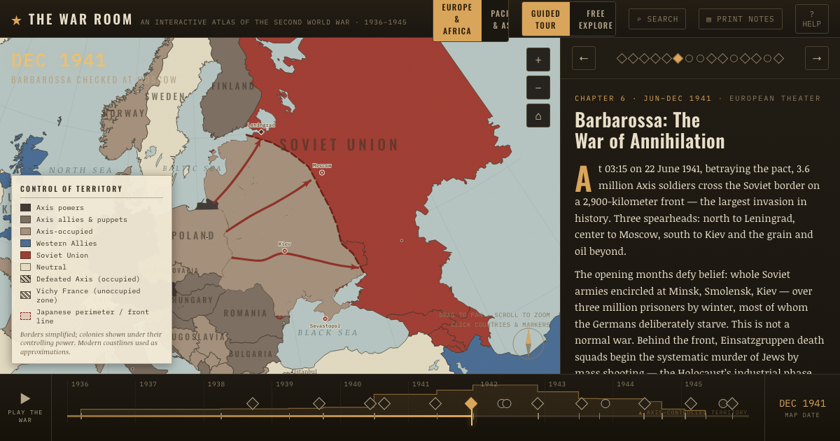
From Balkans and North African campaigns , chapter 5 of The War Room — WW2, 1936–1945 (MAY 1941).
Teach this in 5 minutes Why it happened — Prestige and war. Hitler’s conquests gave Mussolini reason to fear that Italy would have no share in the new European order. His regime prized spectacle, and he…The turn — Crete: victory at a price. German airborne troops captured Crete in May 1941, but a third of the paratroopers were killed or wounded in ten days. Hitler concluded that large…What it changed — The five-week question. The Balkan detour and a late spring moved the invasion of Russia from May to 22 June. Those five weeks invite a difficult question: would Germany…Then ask the room: Was the Balkan campaign a fatal distraction from Barbarossa, or a convenient excuse for its failure? The argued answer is on the chapter page →
The atlas that shows it
THE FREE PRINTABLE STUDY GUIDE
Get the printable study guide for WW2 free. I’ll send you a few short letters, then one when a new atlas opens. That’s all. — Paul
NO TRACKING · YOUR ADDRESS IS USED FOR THE DISPATCH AND NOTHING ELSE ·
UNSUBSCRIBE ANYTIME