MAPS OF HISTORY · ON THIS DAY · May 16 · 1916
ON THIS DAY · 16 MAY 1916
The Sykes–Picot line
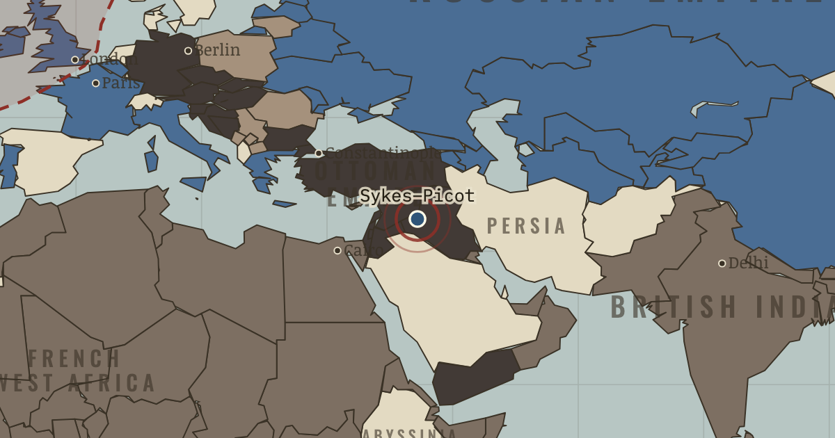
16 May 1916 — The same year as the promises to Hussein, Britain and France secretly rule lines across the post-Ottoman Middle East: “A” for France, “B” for Britain. The Bolsheviks publish the map in 1917. The double promise shapes a century.
THE MOMENT IN CONTEXT
The war became global because the European powers ruled empires, and those empires supplied the men and materials that kept the fighting going. Millions of soldiers, labourers and porters from Africa, Asia, the Pacific and the Americas sustained campaigns they had never chosen to join. India furnished the largest volunteer army yet raised, while the deaths of African porters were enormous but poorly recorded. Japan seized German possessions in China and the Pacific at little cost to itself, and imperial forces fought long campaigns across Africa.
From Chapter 7 — The World’s War of The Great War, 1914–1918 (MAY 1917).
OPEN THE INTERACTIVE MAP →New here? Chapters 1–2 of every atlas are free to sample, and the WW2 atlas is free in full. One membership opens all thirteen — the Cartographer’s Circle.
TEACH THIS IN 5 MINUTES
- Why it happened — Empires wage war with empires. Why was a European war global on day one? Because its belligerents were not countries but systems: shipping lanes, coaling stations, colonial…
- The turn — The double promise, 1916. Between January and May 1916, Britain committed itself to Arab independence and to partition with France over the same territory. It is this atlas’s…
- What it changed — The empires lose their aura. A generation of colonial soldiers saw Europeans die badly, take orders, and depend on colonial labor and loyalty. Wilson’s “self-determination” and…
Then ask the room: “A European civil war with global casualties” — is that a fair description of 1914–18? The argued answer is on the chapter page →
THE ATLAS THAT SHOWS IT
THE DISPATCH
One short letter when a new atlas opens — and the printable study guide for WWI is yours now, free.
NO TRACKING · YOUR ADDRESS IS USED FOR THE DISPATCH AND NOTHING ELSE · UNSUBSCRIBE ANYTIME