ON THIS DAY ·
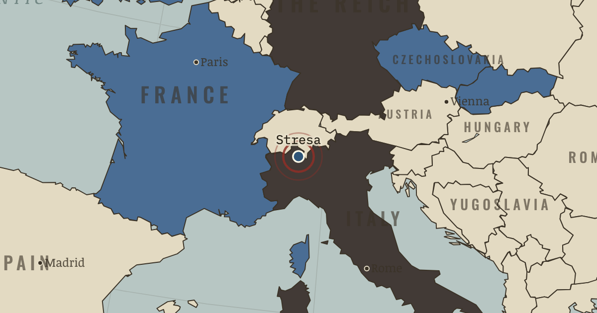
Stresa Front
11–14 Apr 1935 — Britain, France and Italy meet on Lake Maggiore and condemn German rearmament. Within months their “front” comes apart: Britain makes a naval deal with Berlin, and Abyssinia finishes it.
WW2 is free in full, and chapter 1 of every atlas is free. A free account opens 3 more chapters a day. Starter, at $9 a month, opens all 21 with no daily limit — see the plans.
The moment in context
The men who brought Hitler to power thought they had solved a political problem. His movement had mass support, and conservative politicians wanted to turn it against the left. They supported his appointment as chancellor on 30 January 1933, believing that they could control him in office. After the Reichstag fire, emergency decrees curtailed civil liberties; intimidation and the Enabling Act helped the new government remove the republic’s constitutional restraints. The bargain had given Hitler the office from which to build a dictatorship.
From Hitler’s rise and German rearmament, chapter 3 of The Road to War, 1931–1941 (1935).
The place: Stresa Front — map and full story →
Teach this in 5 minutes
- Why it happened — The men who appointed Hitler. From 1930, Weimar chancellors increasingly governed through presidential emergency decrees. The conservatives around Hindenburg, particularly Franz…
- The turn — Stresa, April 1935. In April 1935, Britain, France and Italy met at Stresa on Lake Maggiore. They condemned German rearmament and reaffirmed Austria’s independence. The…
- What it changed — An unequal rearmament timetable. One estimate puts German army spending in 1936 at perhaps ten times Britain’s, though the comparison depends on what is counted. Britain and France…
Then ask the room: Hitler wrote his program in Mein Kampf a decade before power. Why did so few statesmen believe him? The argued answer is on the chapter page →
The atlas that shows it
THE FREE PRINTABLE STUDY GUIDE
Get the printable study guide for The Road to War free. I’ll send you a few short letters, then one when a new atlas opens. That’s all. — Paul
NO TRACKING · YOUR ADDRESS IS USED FOR THE DISPATCH AND NOTHING ELSE · UNSUBSCRIBE ANYTIME