MAPS OF HISTORY · ON THIS DAY · MARCH 21 · Operation Michael (1918)ON THIS DAY · 21 MARCH 1918
Operation Michael
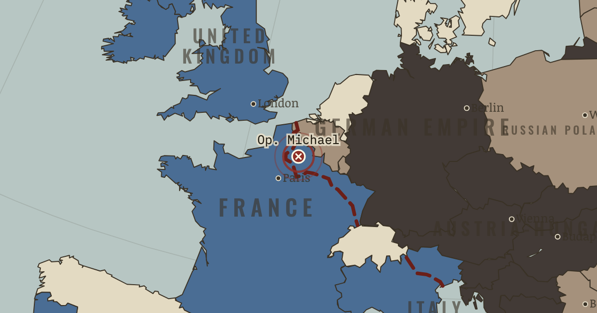
21 Mar 1918 — A five-hour hurricane bombardment opens Operation Michael. Seventy-six divisions of stormtroops break the British Fifth Army and advance 65 km in a week, farther than any force has advanced since 1914. But the guns, supplies and plan cannot keep pace with them.
21 MARCH 1918 · THE GREAT WAR, 1871–1923 These maps are reconstructed from published sources · Cliopatria v 0.2.1 · National Army Museum: Mesopotamia campaign · Natural Earth physical geography · National Army Museum: Ramadi, September 1917 · Maps of History: Great War geographic decisions · National Army Museum: Salonika campaign · US Military Academy World War I atlas, chart 15 · US Military Academy World War I atlas, chart 18 · US Military Academy World War I atlas, chart 39 · US Military Academy World War I atlas, chart 41 · US Military Academy World War I atlas, chart 47 · US Military Academy World War I atlas, chart 49
Source details Cliopatria contributors / Seshat Global History Databank. Source polygons retained with original identities; geographic selections and corrections by Maps of History.. CC BY 4.0 National Army Museum; Basra, Kut, Baghdad and late 1917 campaign positions.. Historical evidence citation, no artwork copied Made with Natural Earth; geographic reference and physical land only. No modern political boundary is used as a historical boundary.. Public domain National Army Museum, accession 1965-10-209-49; Ramadi captured 28–29 September 1917.. Historical evidence citation Maps of History. Campaign-sector connectors and contextual regions are identified separately from imported vector outlines.. Original geographic reconstruction using attributed historical evidence National Army Museum: late 1916 Albanian coast–Monastir–Doiran–Struma line and 1918 liberation campaign.. Historical evidence citation; no artwork copied US Military Academy, Department of History & War Studies, World War I chart 15. Selected geographic front facts reconstructed independently; no claim of blanket public-domain artwork rights.. Geographic evidence citation; source index requests permission for map reprints. Original artwork is not redistributed. US Military Academy, Department of History & War Studies, World War I chart 18. Selected geographic front facts reconstructed independently; no claim of blanket public-domain artwork rights.. Geographic evidence citation; source index requests permission for map reprints. Original artwork is not redistributed. US Military Academy, Department of History & War Studies, World War I chart 39. Selected geographic front facts reconstructed independently; no claim of blanket public-domain artwork rights.. Geographic evidence citation; source index requests permission for map reprints. Original artwork is not redistributed. US Military Academy, Department of History & War Studies, World War I chart 41. Selected geographic front facts reconstructed independently; no claim of blanket public-domain artwork rights.. Geographic evidence citation; source index requests permission for map reprints. Original artwork is not redistributed. US Military Academy, Department of History & War Studies, World War I chart 47. Selected geographic front facts reconstructed independently; no claim of blanket public-domain artwork rights.. Geographic evidence citation; source index requests permission for map reprints. Original artwork is not redistributed. US Military Academy, Department of History & War Studies, World War I chart 49. Selected geographic front facts reconstructed independently; no claim of blanket public-domain artwork rights.. Geographic evidence citation; source index requests permission for map reprints. Original artwork is not redistributed. Annual source features can describe claims, legal territory or military control. Occupied extensions are separated from the prewar Central Power homelands, while the original source names and shapes remain available.
The area east/north of the sourced western front is selected within the 1914 historical French, Belgian and Luxembourg footprints. It represents military control, not annexation.
The displayed state is iss 18 jul. Geographic reference dates and reconstruction methods are recorded for each feature.
reconstruction: 12 November 1917 Piave withdrawal reference · reconstruction: 1871–1918 · reconstruction: 1917 annual control · reconstruction: 1918 limit of occupation after Brest-Litovsk · reconstruction: 1918.52 · reconstruction: 30 December 1917 · reconstruction: 30 December 1917 northern line reference · reconstruction: Late 1916 allied line · reconstruction: Late 1917 campaign-sector reference · reconstruction: Maximum advances through 18 July 1918
Layer records and reconstruction methods
The moment in context Germany’s leaders faced a narrowing opportunity in 1918. Divisions released from the east could strengthen an attack in France, but American troops were arriving to reinforce the Allies. Operation Michael began on 21 March with a short, intense bombardment. Stormtroopers passed around strongpoints and broke into the British Fifth Army’s front, carrying the German advance farther than any since 1914.
From Spring Offensive and Hundred Days , chapter 12 of The Great War, 1871–1923 (AUG 1918).
The place: Operation Michael — map and full story →
Teach this in 5 minutes Why it happened — Why the trench finally broke. A defended line became more vulnerable when artillery could calculate fire without warning registration shots. Infiltration or armor helped troops…The turn — Amiens, 8 August 1918. At Amiens on 8 August, defenders faced an attack they had not heard being prepared. Roughly 15,000 German troops surrendered in hours, and some…What it changed — Five weeks, three armistices. The coalition came apart over five weeks. Bulgaria signed an armistice on 29 September, the Ottoman Empire on 30 October and Austria-Hungary on 3…Then ask the room: Could a different German strategy have won in 1918, or were the spring offensives a hopeless gamble? The argued answer is on the chapter page →
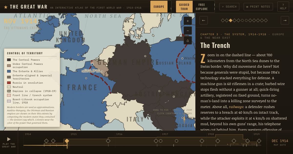
The atlas that shows it
THE FREE PRINTABLE STUDY GUIDE
Get the printable study guide for WWI free. I’ll send you a few short letters, then one when a new atlas opens. That’s all. — Paul
NO TRACKING · YOUR ADDRESS IS USED FOR THE DISPATCH AND NOTHING ELSE ·
UNSUBSCRIBE ANYTIME