MAPS OF HISTORY · ON THIS DAY · MARCH 9 · Battle of Hampton Roads (1862)ON THIS DAY · 9 MARCH 1862
Battle of Hampton Roads
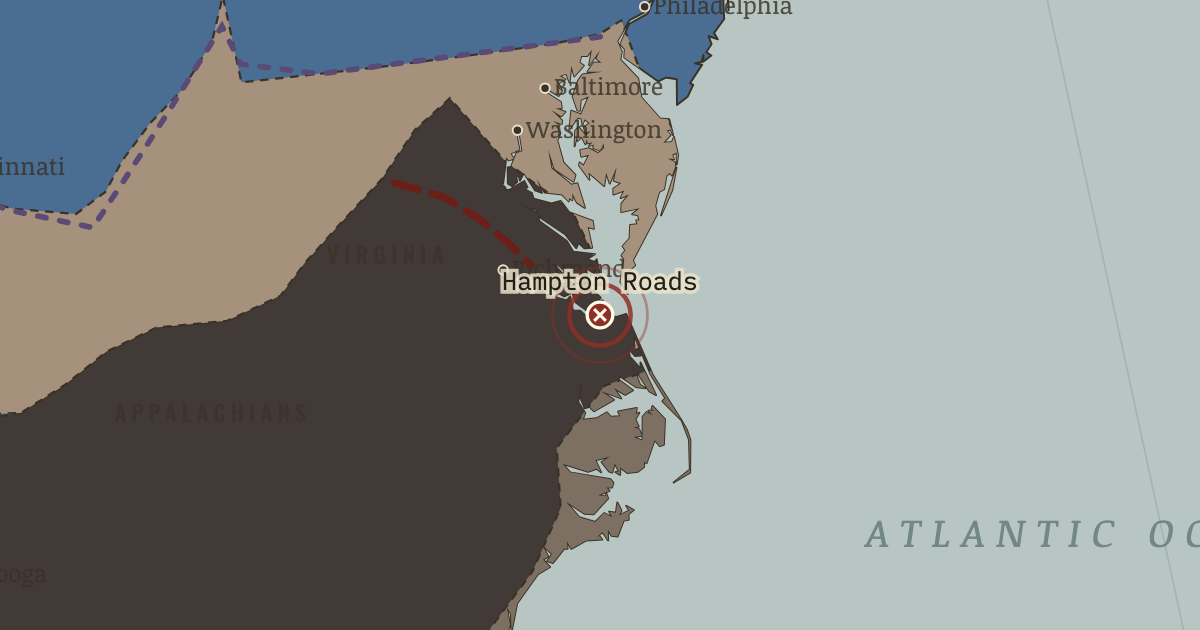
8–9 Mar 1862 — CSS Virginia sinks two wooden warships in one afternoon. The following morning, the turreted USS Monitor fights her to a standstill. The encounter shows how quickly ironclads have made the world’s wooden navies obsolete.
9 MARCH 1862 · THE AMERICAN CIVIL WAR, 1840–1877 These maps are reconstructed from published sources · US Military Academy: Principal Campaigns of the War · US Military Academy: Strategic Situation at the End of the Campaign, 27 February 1862 · US Military Academy: Richmond and Peninsula, 1862 – Stuart’s Raid, 12–15 June · US Military Academy: Southeastern United States, 1861 · US Military Academy: Chattanooga and Vicinity, 1863 – Movements Since 24 June · US Military Academy: Grant’s Plan for the 1864 Campaign · US Military Academy: Principal Federal Movements, November 1864 – April 1865 · National Park Service: Port Royal and the Sea Islands · Cliopatria v 0.2.1 · Fort Donelson National Battlefield · Newberry Atlas of Historical County Boundaries: historical states and territories · Maps of History: Civil War source decisions
Source details US Military Academy Department of History; selected geographic facts reconstructed independently, original chart retained outside distributed files.. Geographic evidence only. Source atlas index requests reprint permission; original artwork not redistributed. US Military Academy Department of History; selected geographic facts reconstructed independently, original chart retained outside distributed files.. Geographic evidence only. Source atlas index requests reprint permission; original artwork not redistributed. US Military Academy Department of History; selected geographic facts reconstructed independently, original chart retained outside distributed files.. Geographic evidence only. Source atlas index requests reprint permission; original artwork not redistributed. US Military Academy Department of History; selected geographic facts reconstructed independently, original chart retained outside distributed files.. Geographic evidence only. Source atlas index requests reprint permission; original artwork not redistributed. US Military Academy Department of History; selected geographic facts reconstructed independently, original chart retained outside distributed files.. Geographic evidence only. Source atlas index requests reprint permission; original artwork not redistributed. US Military Academy Department of History; selected geographic facts reconstructed independently, original chart retained outside distributed files.. Geographic evidence only. Source atlas index requests reprint permission; original artwork not redistributed. US Military Academy Department of History; selected geographic facts reconstructed independently, original chart retained outside distributed files.. Geographic evidence only. Source atlas index requests reprint permission; original artwork not redistributed. National Park Service; November1861 Port Royal occupation. The early coastline layer is date-specific, not the entire1862 coastal gain.. US government historical geographic evidence Cliopatria contributors / Seshat Global History Databank. Selected, combined, reprojected and corrected by Maps of History as described per layer.. CC BY4.0 National Park Service; February1862 river forts and Nashville campaign.. US government historical geographic evidence The Newberry Library, Atlas of Historical County Boundaries. State/territory records unioned for the displayed date; disputed/joint territories excluded from exclusive US sovereignty.. Publisher permits commercial and noncommercial lawful reuse without fees; current terms supersede obsolete NC notice in archive Source-native legal boundaries, annual military control and independently reconstructed campaign sectors are kept separate. Region connectors and corridor widths are interpretive.. Original historical reconstruction with attributed evidence Legal US boundaries come from dated Newberry records. Secession and military control use separate source layers, while campaign corridors are educational geographic reconstructions rather than surveyed continuous fronts.
reconstruction: 1845 · reconstruction: 1861 · reconstruction: 1861-04-13 · reconstruction: 1861-07-21 · reconstruction: 1862 · reconstruction: 1862-02-28 · reconstruction: 1862-06-08 · reconstruction: June1862 Richmond/Chickahominy campaign sector; no continuous national front · reconstruction: June1862–January1863 western theater regional connector through Union Memphis/Corinth and the middleTennessee campaign; later Tullahoma chart supplies place geography, not a claim of uniform June1863 control · vector: 1860 state-interface reference · vector: us-e24e487b916d
Layer records and reconstruction methods
The moment in context A blockade need not catch every ship to put pressure on a country. A merchant who risks capture or delay must pay more for freight and insurance, and the buyer must pay more in turn. As the Union navy grew from a few dozen ships to hundreds, the Confederacy received fewer useful supplies at higher prices. Bases taken along the coast served another purpose too: at Port Royal, enslaved people escaped to the fleet. Commanders then had to decide whether to return them to their claimants or protect their freedom.
From Anaconda Plan and the river war , chapter 5 of The American Civil War, 1840–1877 (APR 1862).
The place: Battle of Hampton Roads — map and full story →
Teach this in 5 minutes Why it happened — Geography as strategy. The Confederate defensive line could be crossed by water. The Tennessee and Cumberland gave Union vessels routes south, carrying supplies past roads…The turn — Shiloh, 6–7 April 1862. Albert Sidney Johnston attacked Grant at dawn on 6 April, hoping to destroy the Union army at Shiloh before reinforcements arrived and close the…What it changed — The Confederate heartland starts to bleed. Nashville and Memphis brought Southern iron and gunpowder mills and a productive farm belt within Union reach. The grey-tan wedge in Tennessee does…Then ask the room: Why could a slow strategy such as blockade gain support alongside campaigns for a decisive battle? The argued answer is on the chapter page →
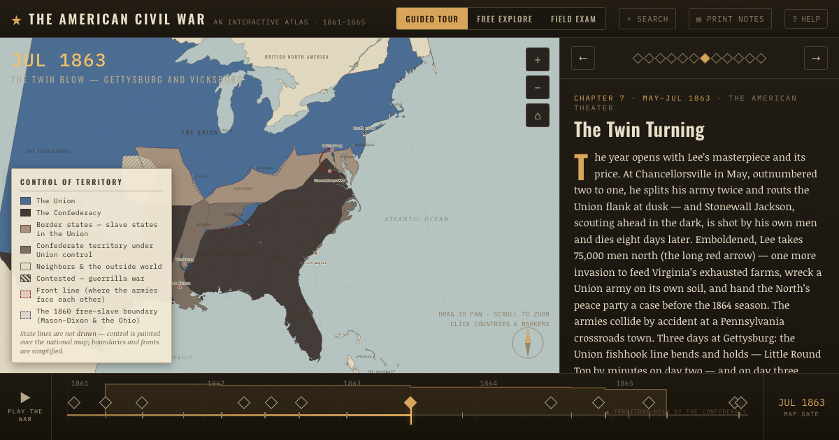
The atlas that shows it
THE FREE PRINTABLE STUDY GUIDE
Get the printable study guide for The American Civil War free. I’ll send you a few short letters, then one when a new atlas opens. That’s all. — Paul
NO TRACKING · YOUR ADDRESS IS USED FOR THE DISPATCH AND NOTHING ELSE ·
UNSUBSCRIBE ANYTIME