4 ATLASES
History of the United States Virgin Islands in maps
The United States Virgin Islands as it appears in 4 interactive history atlases, from 1789 to 2015: United States Virgin Islands. Each era below lists who ruled the land and when control changed, linked to the dated map that shows it.
WW2 is free in full, and chapter 1 of every atlas is free. A free account opens 3 more chapters a day. Starter, at $9 a month, opens all 21 with no daily limit — see the plans.
Free printable Feminism and the Tunisian Revolution study guide, sent by email ↓
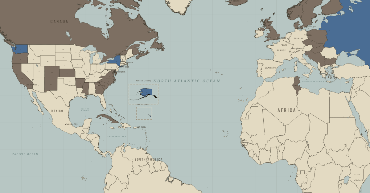
What was the United States Virgin Islands before it was United States Virgin Islands? The sections below follow this land through every era covered by the Maps of History atlases: who ruled it, what it was called, and when control changed. Each line links to the dated map. Modern borders serve as an approximation, as each atlas says on the map itself.
United States Virgin Islands · Haiti and Kenya independence
The sugar colonies of St Croix, St Thomas and St John formed the Danish West Indies, today’s US Virgin Islands. In July 1848 enslaved workers on St Croix rose and forced the governor to proclaim emancipation, echoing Haiti’s revolution half a century earlier. Denmark sold the islands to the United States in 1917.
| Under colonial rule — the opening position |
HAITI AND KENYA INDEPENDENCE: EVERY CHAPTER AND MAP →
United States Virgin Islands · WWI
United States Virgin Islands · Cold War
COLD WAR: EVERY CHAPTER AND MAP →
United States Virgin Islands · Feminism and the Tunisian Revolution
| Right won in law — the opening position | |
| No reform yet / outside this story | |
| Partial or unequal; treaty signed only; transition |
FEMINISM AND THE TUNISIAN REVOLUTION: EVERY CHAPTER AND MAP →
Related
THE FREE PRINTABLE STUDY GUIDE
Get a printable atlas study guide of your choice free. I’ll send you a few short letters, then one when a new atlas opens. That’s all. — Paul
NO TRACKING · YOUR ADDRESS IS USED FOR THE DISPATCH AND NOTHING ELSE · UNSUBSCRIBE ANYTIME