The War Room — WW2, 1936–1945 · THE MAP IN
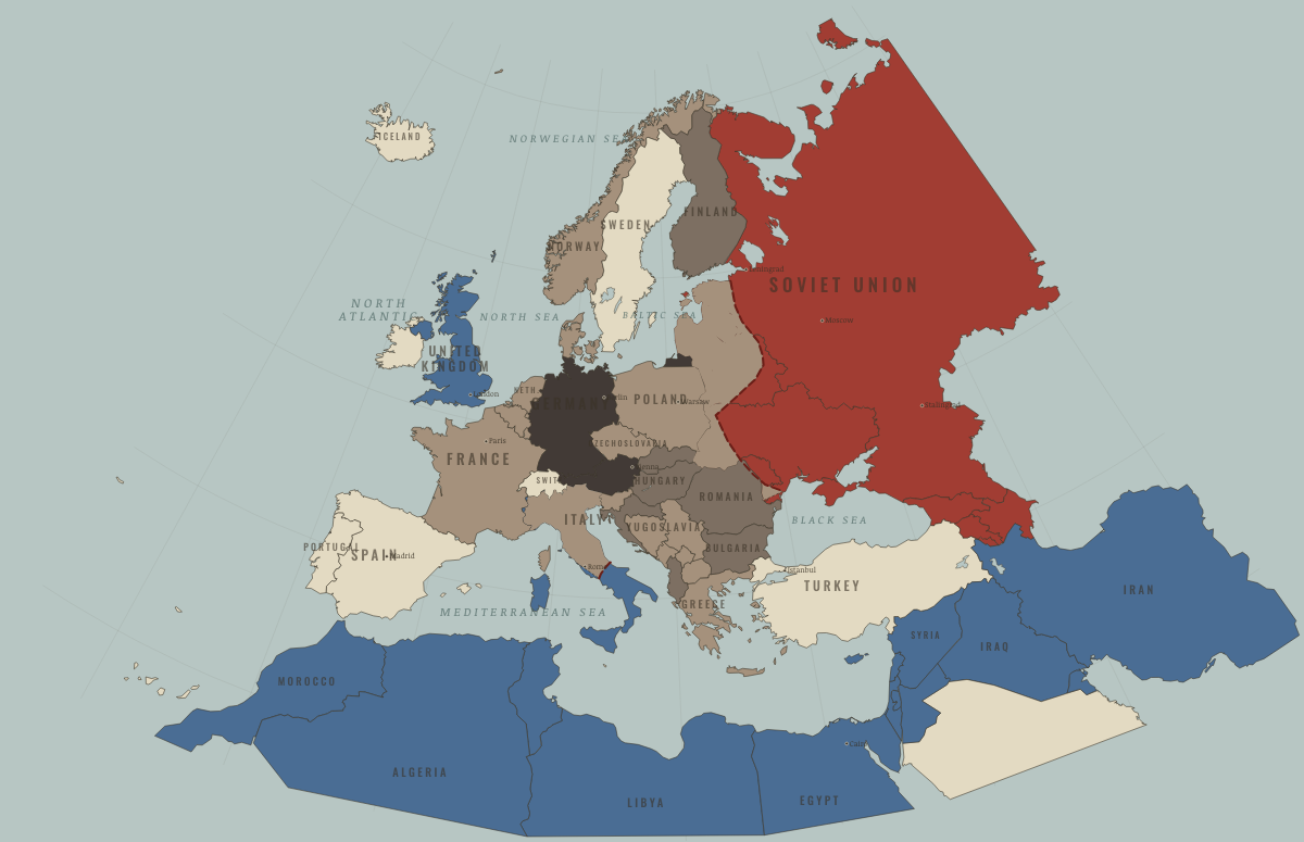
Map of Europe in June 1944
The vice closes · WW2
Europe in June 1944: The vice closes. The map shows who held what: Western Allies, Axis-occupied, Soviet Union.
 JUN 1944 · THE WAR ROOM — WW2, 1936–1945
On the ground
- Western regions under German occupation
- Northern Italy under German occupation and the Salò Republic
The chapters of this moment
Related maps
◧ EMBED THIS MAP ON YOUR SITE
You may embed this map free if you keep the attribution link. Teachers can find print-ready
study guides at /study/.
THE FREE PRINTABLE STUDY GUIDE
Get the printable study guide for WW2 free. I’ll send you a few short letters, then one when a new atlas opens. That’s all. — Paul
NO TRACKING · YOUR ADDRESS IS USED FOR THE DISPATCH AND NOTHING ELSE ·
UNSUBSCRIBE ANYTIME