China in Revolution, 1911–1949 · THE MAP IN
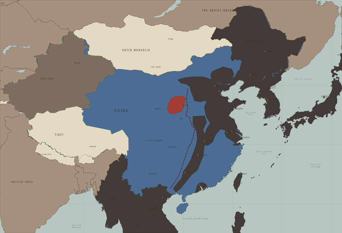
Map of China in 1944
Ichigo — points and lines
China in 1944: Ichigo — points and lines. The map shows who held what: The Empire of Japan & its puppets, Foreign empires — British, French, Russian, American, The Republic of China — the government at the time.
WW2 is free in full, and chapter 1 of every atlas is free. A free account opens 3 more chapters a day. Starter, at $9 a month, opens all 21 with no daily limit — see the plans.
Free printable Chinese Revolution study guide, sent by email ↓
On the ground
- The 1944 Ichigo corridor cut a rail spine through Free China. It connected points and lines rather than securing possession of the whole area.
The chapters of this moment
Related maps
THE FREE PRINTABLE STUDY GUIDE
Get the printable study guide for China in Revolution free. I’ll send you a few short letters, then one when a new atlas opens. That’s all. — Paul
NO TRACKING · YOUR ADDRESS IS USED FOR THE DISPATCH AND NOTHING ELSE · UNSUBSCRIBE ANYTIME