MAPS OF HISTORY · WW2 · BATTLES AND EVENTS · Surrender of JapanWW2 · TURNING POINT · 1945
Surrender of Japan (1945)
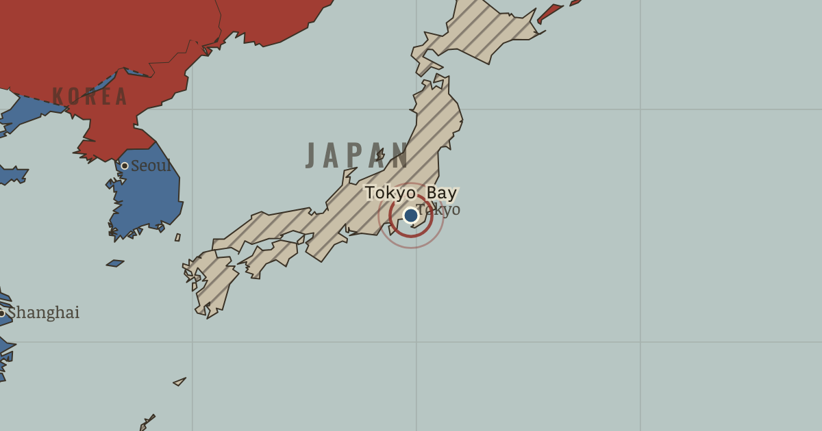
On the WW2 map as “Surrender in Tokyo Bay”
2 Sep 1945 — Japan signs its surrender aboard USS Missouri in Tokyo Bay, bringing the Second World War to an end. An estimated 60 million people have died.
When 2 Sep 1945 Type Turning point Chapter End of WW2 in the Pacific (chapter 14 of WW2)Atlas The War Room — WW2, 1936–1945 TURNING POINT · THE WAR ROOM — WW2, 1936–1945 These maps are reconstructed from published sources · US Army Center of Military History — American Military History, The War Against Japan · Cliopatria v0.2.1 — dated political boundaries · Natural Earth — physical reference geography
Source details Office of the Chief of Military History,1969, chapter23. Official US Army text and maps; public domain Cliopatria contributors / Seshat Global History Databank. CC BY4.0 · Dated polity and constituent territory selections; campaign-dependent occupation overlays reconstructed separately. Natural Earth. Public domain The post-surrender state uses 1946 aggregate control and the earliest separately published Japanese and Korean outlines as disclosed regional references. Administrative transitions in late August and September share this ending chapter.
The separately published Tibetan polity remains neutral. The authored modern-China interaction region does not make Tibet a Chinese battlefield or Allied-controlled territory.
The dates of published political outlines retain the resolution available in their sources. Military fronts and operational perimeters have their own source and method records.
proxy: Earliest separately published postwar source region;1945occupation reference · reconstruction: 1936–1937 · reconstruction: 1936–1937 source state · reconstruction: 1945 · reconstruction: 1945.62 · reconstruction: 1946–1946 · reconstruction: 1946–2023 · vector: 1890–1978 · vector: 1890–2023 · vector: 1932–1955 · vector: 1939–1946 · vector: 1944–1946 · vector: 1945–1947 · vector: 1946–1946 · vector: 1946–1948 · vector: 1946–1975
Layer records and reconstruction methods
In the same chapter
Related
THE FREE PRINTABLE STUDY GUIDE
Get the printable study guide for WW2 free. I’ll send you a few short letters, then one when a new atlas opens. That’s all. — Paul
NO TRACKING · YOUR ADDRESS IS USED FOR THE DISPATCH AND NOTHING ELSE ·
UNSUBSCRIBE ANYTIME