MAPS OF HISTORY · ANCIENT ROME · MAPS BY YEAR · AD 451The Rise and Fall of Rome, 264 BC – AD 476 · THE MAP IN AD 451
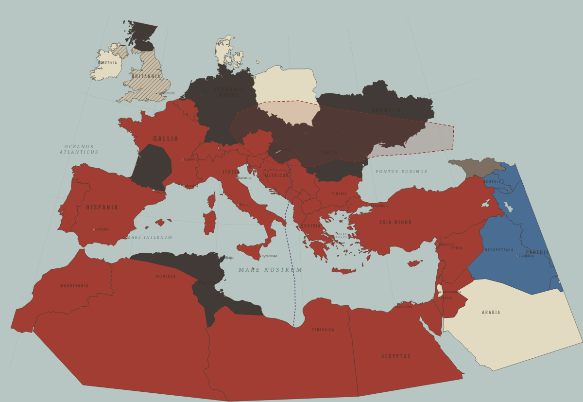
Map of the Roman Empire in AD 451
Attila
The Roman Empire in AD 451: Attila. The map shows who held what: Roman territory, Tribal peoples & confederations, Rival great powers.
AD 451 · THE RISE AND FALL OF ROME, 264 BC – AD 476 These maps are reconstructed from published sources · Cliopatria v0.2.1 · Natural Earth physical coastlines and rivers
Source details Cliopatria contributors / Seshat Global History Databank. Selected, combined, and reprojected by Maps of History; dated adjustments are recorded per layer.. CC BY 4.0 Made with Natural Earth. Modern physical geography is a coastline/river reference, not evidence of ancient sovereignty.. Public domain The source451 Hunnic extent includes the campaign into Gaul. It appears only in the existing sphere/contested overlay, rather than as a new solid claim of sovereignty.
reconstruction: 451 · reconstruction: AD395 East/West source boundary · reconstruction: AD395 western footprint compared with AD451 · reconstruction: Modern physical shoreline reference · vector: 283 to 454 · vector: 347 to 646 · vector: 387 to 475 · vector: 402 to 489 · vector: 402 to 509 · vector: 402 to 533 · vector: 426 to 454 · vector: 441 to 457 · vector: 441 to 461 · vector: 443 to 454 · vector: 451 to 451 · vector: 451 to 454 · vector: 451 to 489
Layer records and reconstruction methods
On the ground This territory lies within the area paying tribute to Attila’s Huns The chapters of this moment
Related maps
◧ EMBED THIS MAP ON YOUR SITE
You may embed this map free if you keep the attribution link. Teachers can find print-ready
study guides at /study/ .
THE FREE PRINTABLE STUDY GUIDE
Get the printable study guide for Rome free. I’ll send you a few short letters, then one when a new atlas opens. That’s all. — Paul
NO TRACKING · YOUR ADDRESS IS USED FOR THE DISPATCH AND NOTHING ELSE ·
UNSUBSCRIBE ANYTIME