MAPS OF HISTORY · AGE OF REVOLUTIONS · MAPS BY YEAR · May 1810The Age of Revolutions, 1775–1848 · THE MAP IN MAY 1810
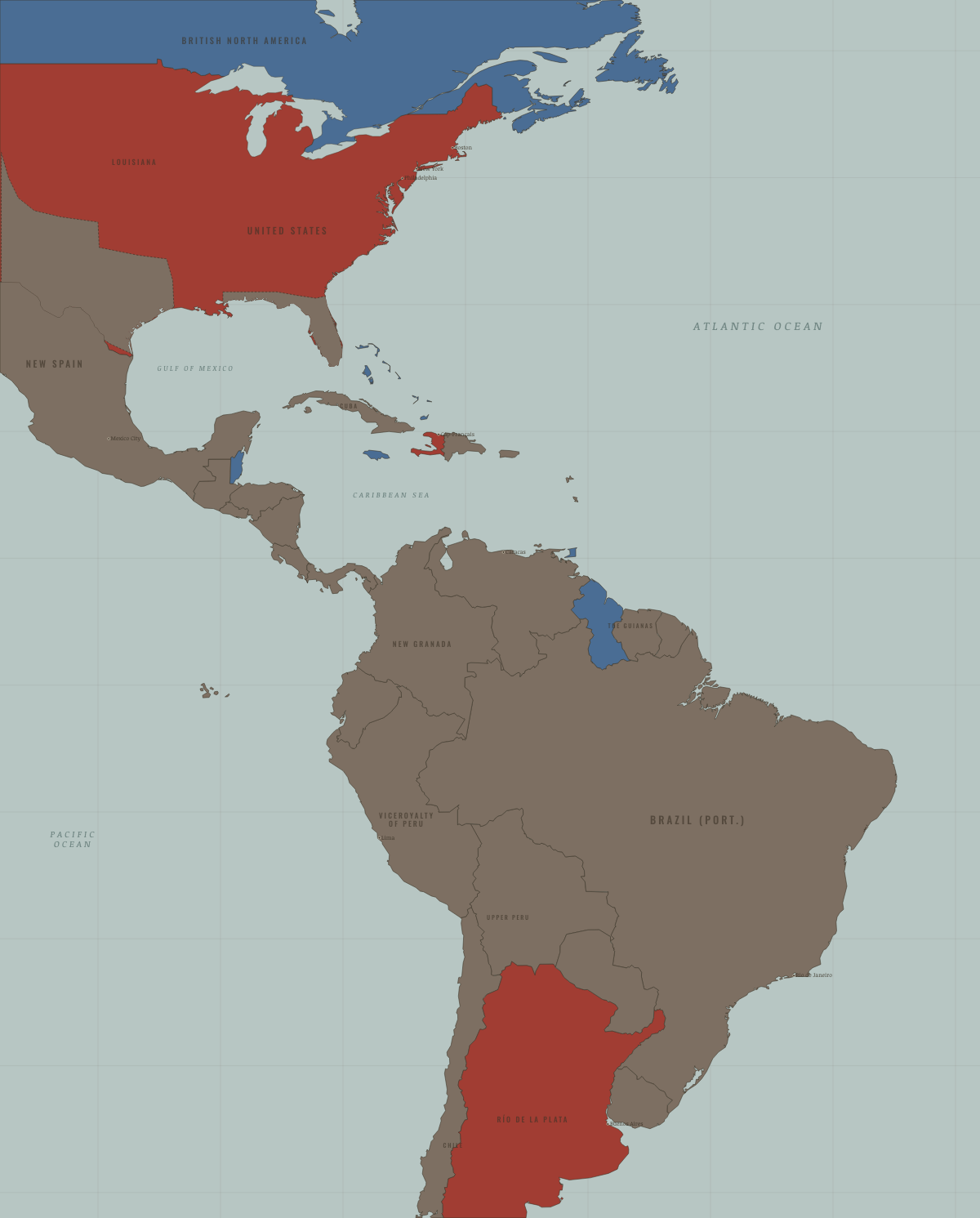
Map of the Atlantic world in May 1810
The juntas · Age of Revolutions
The Atlantic world in May 1810: The juntas. Since January 1804, 1 territory changed status on this map: Río de la Plata (mod. Argentina).
MAY 1810 · THE AGE OF REVOLUTIONS, 1775–1848 These maps are reconstructed from published sources · Cliopatria v 0.2.1 · Embassy of Haiti: Key Dates · Natural Earth physical geography · Newberry Atlas of Historical County Boundaries: historical states and territories
Source details Cliopatria contributors / Seshat Global History Databank. Selected, combined, reprojected and corrected by Maps of History as described per layer.. CC BY4.0 Embassy of Haiti; the island-wide source polygons after 1806 are national footprint references rather than proof of one undivided administration.. Historical evidence citation Made with Natural Earth; present coastlines support physical clipping, not historical political boundaries.. Public domain The Newberry Library, Atlas of Historical County Boundaries. State/territory records unioned for the displayed date; disputed/joint territories excluded from exclusive US sovereignty.. Publisher permits commercial and noncommercial lawful reuse without fees; current terms supersede obsolete NC notice in archive Annual source outlines can combine imperial claims with areas of control. The labels identify the historical role selected, while dates finer than the source interval are made explicit in these details.
The US outline follows dated Newberry legal and administrative records. Other, joint and disputed territories are excluded from exclusive US fill. The outline says nothing about Indigenous consent or actual settlement.
The Haitian national footprint includes the northern and southern administrations that were divided from 1807 to 1820. Their uniform revolutionary status on the map does not imply an undivided government.
reconstruction: 1810.4 · vector: 1805–1813 · vector: 1809–1810 · vector: 1809–1813 · vector: 1809–1821 · vector: 1810-05-01
Layer records and reconstruction methods
What changes on the map
Related maps
◧ EMBED THIS MAP ON YOUR SITE
You may embed this map free if you keep the attribution link. Teachers can find print-ready
study guides at /study/ .
THE FREE PRINTABLE STUDY GUIDE
Get the printable study guide for The Age of Revolutions free. I’ll send you a few short letters, then one when a new atlas opens. That’s all. — Paul
NO TRACKING · YOUR ADDRESS IS USED FOR THE DISPATCH AND NOTHING ELSE ·
UNSUBSCRIBE ANYTIME