MAPS OF HISTORY · FEMINISM AND THE TUNISIAN REVOLUTION · BATTLES AND EVENTS · Tunisia–Libya border barrierFeminism and the Tunisian Revolution · TURNING POINT · 2015–16
Tunisia–Libya border barrier (2015–16)
On the Feminism and the Tunisian Revolution map as “The border barrier”
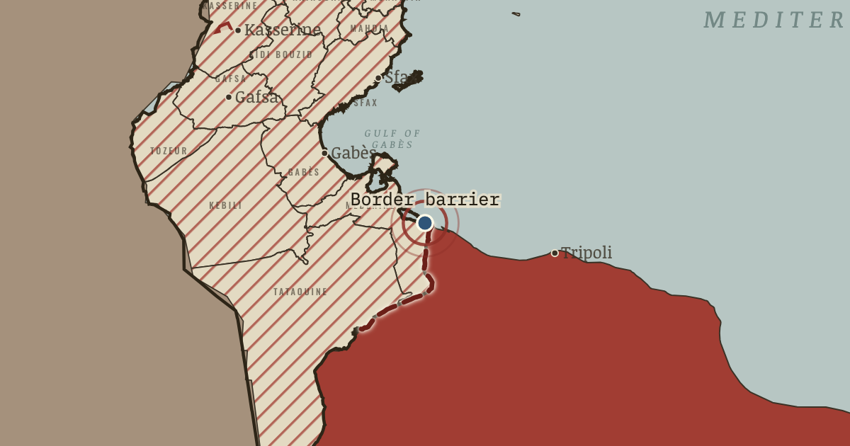
2015–16 — To stop weapons and fighters crossing from Libya, Tunisia digs a trench and builds a sand berm along some 200 km of the border, from Ras Ajdir towards Dehiba. The barrier also cuts the smuggling trade on which many border towns live.
When 2015–16 Type Turning point Chapter Terrorism in Tunisia (chapter 11 of Feminism and the Tunisian Revolution)Atlas Protest and Change: Second-Wave Feminism and Tunisia, 1945–2015 TURNING POINT · PROTEST AND CHANGE: SECOND-WAVE FEMINISM AND TUNISIA, 1945–2015 These maps are reconstructed from published sources · Cliopatria v0.2.1 historical polities · Tunisia governorates, geoBoundaries gbOpen (2017 reference) · Tunisia: Republican order 2014-70, official gazette p.981 · Tunisia: Presidential decree 2015-120, official gazette p.1910 · Tunisia barrier endpoints reported by the Libyan News Agency, 12 July 2015 · Natural Earth 1:10m countries and physical geography · UN experts’ report on Tunisian fighters, July 2015
Source details Cliopatria contributors / Seshat Global History Databank. CC BY 4.0 · Selected source records; component selection, documented unions and date proxies; projected for display. © OpenStreetMap contributors; Wambacher; geoBoundaries. ODbL-1.0 (upstream OpenStreetMap/Wambacher) · ISO-to-atlas ID crosswalk; projection; governorate unions and border-corridor extraction. Source coordinates retained. République Tunisienne, Journal officiel 18 April 2014; Library of Congress scan. Factual historical evidence; no source prose reproduced République Tunisienne, Journal officiel 7 July 2015; Library of Congress scan. Factual historical evidence; no source prose reproduced Libyan News Agency reporting Tunisian defence minister; endpoint evidence, not an engineering alignment. Factual historical evidence; no source prose reproduced Natural Earth. Public domain · Property selection and semantic ID normalization; full coordinates retained. An upstream Egyptian ring self-intersection is repaired with area change below 1e-9 square degrees; see natural-earth-admin0-review.json. United Nations. Factual historical evidence; no source prose reproduced The governorate geometry comes from the published 2017 reference. Earlier snapshots use the same grid to locate events, without claiming that these 24 administrative units existed throughout 1945–2015.
The barrier line follows the reported corridor where construction began in 2015; it does not show a complete as-built barrier in July.
reconstruction: 11 April 2014; confirmed 6 July 2015 · reconstruction: 2015 reported route; 2017 geographic reference · vector: 1976–2023 · vector: 2017
Layer records and reconstruction methods
In the same chapter
Related
THE FREE PRINTABLE STUDY GUIDE
Get the printable study guide for Protest and Change free. I’ll send you a few short letters, then one when a new atlas opens. That’s all. — Paul
NO TRACKING · YOUR ADDRESS IS USED FOR THE DISPATCH AND NOTHING ELSE ·
UNSUBSCRIBE ANYTIME