MAPS OF HISTORY · INDUSTRIAL REVOLUTION · BATTLES AND EVENTS · Merthyr Tydfil ironworksIndustrial Revolution · TURNING POINT · 1800–40
Merthyr Tydfil ironworks (1800–40)
On the Industrial Revolution map as “Merthyr Tydfil”
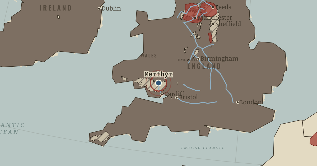
c. 1800–1840 — The great ironworks of Cyfarthfa and Dowlais turn a Welsh village into Wales’s biggest town. The largest ironworks in the world send their iron to Cardiff along the Glamorganshire Canal. Their workers rise in 1831.
When c. 1800–1840 Type Turning point Chapter Steam power, coal and iron (chapter 3 of Industrial Revolution)Atlas The Industrial Revolution, 1750–1914 TURNING POINT · THE INDUSTRIAL REVOLUTION, 1750–1914 These maps are reconstructed from published sources · Bartholomew: Literary & Historical Atlas of Europe,1914 · BGS Geology625k: Coal Measures bedrock polygons · Canal & River Trust: historic canals · Cliopatria v 0.2.1 · Natural Earth physical geography · Maps of History: industrial geography reconstruction record · UNESCO: Cornwall and West Devon mining · UNESCO: Derwent Valley Mills
Source details John George Bartholomew,1914; economic maps printedpp48–49 and53; railwayspp50–51. Original author died1920. Public-domain original scan; commercially restricted MapsETC derivative not used.. Public-domain original historical cartography; geographic facts independently reconstructed Contains British Geological Survey materials © UKRI2026. Geological outlines are not mine-operation boundaries.. Open Government Licence3.0; free commercial reuse with attribution Canal & River Trust route histories, named canal endpoints and opening chronology.. Independent named-route reconstruction; no modern map artwork copied Cliopatria contributors / Seshat Global History Databank. Selected, combined, reprojected and corrected by Maps of History as described per layer.. CC BY4.0 Made with Natural Earth; present coastlines support physical clipping, not historical political boundaries.. Public domain Named districts and route stations from the linked published atlases. District perimeters are interpretive economic regions, not sovereign borders or parcel-level industrial land use.. Original independent thematic reconstructions; source artwork not embedded UNESCO World Heritage Centre; named industrial locations and period evidence. The atlas district is not a copy of the modern UNESCO property boundary.. Factual geographic evidence; property artwork not redistributed UNESCO World Heritage Centre; named industrial locations and period evidence. The atlas district is not a copy of the modern UNESCO property boundary.. Factual geographic evidence; property artwork not redistributed Country fills apply the existing educational industrialisation stages to dated published polities. They do not imply that development was uniform throughout each empire. Economic districts represent thematic regions. Source dates and reconstruction methods are recorded separately.
reconstruction: 1785 · reconstruction: 1800 · reconstruction: 1820 · reconstruction: Named district within chapter chronology · vector: 1811–1848 · vector: 1811–1869 · vector: 1812–1823 · vector: 1814–1863 · vector: 1815–1823 · vector: 1815–1827 · vector: 1815–1829 · vector: 1815–1833 · vector: 1815–1847 · vector: 1815–1937 · vector: 1820–1821 · vector: 1820–1824 · vector: 1820–1827 · vector: 1820–1829 · vector: 1820–1833 · vector: 1820–1839 · vector: 1820–1847 · vector: 1820–1848 · vector: 1820–1863 · vector: 1820–1864 · vector: 1820–1865 · vector: 1820–1869 · vector: 1820–1899 · vector: Carboniferous geology / published2007
Layer records and reconstruction methods
In the same chapter
Related
THE FREE PRINTABLE STUDY GUIDE
Get the printable study guide for The Industrial Revolution free. I’ll send you a few short letters, then one when a new atlas opens. That’s all. — Paul
NO TRACKING · YOUR ADDRESS IS USED FOR THE DISPATCH AND NOTHING ELSE ·
UNSUBSCRIBE ANYTIME