The Road to War, 1931–1941 · THE MAP IN
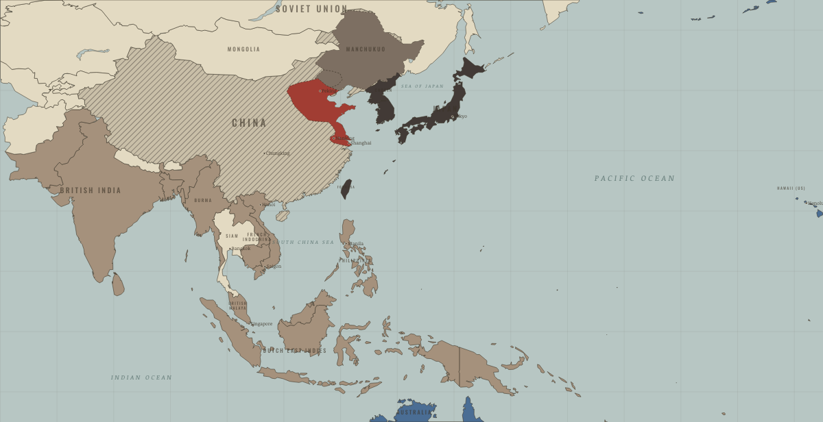
Map of East Asia and the Pacific in July 1937
Marco Polo Bridge — the China war · road to WW2
East Asia and the Pacific in July 1937: Marco Polo Bridge — the China war. Since March 1933, 1 territory changed status on this map: People's Republic of China.
Open this map in the interactive atlas →
WW2 is free in full, and chapter 1 of every atlas is free. A free account opens 3 more chapters a day. Starter, at $9 a month, opens all 21 with no daily limit — see the plans.
What changes on the map
| People's Republic of China | Neutral & unaligned → At war on its own soil |
On the ground
- By 1937, Japan occupied the north China plain and the Shanghai–Nanking corridor.
Related maps
THE FREE PRINTABLE STUDY GUIDE
Get the printable study guide for The Road to War free. I’ll send you a few short letters, then one when a new atlas opens. That’s all. — Paul
NO TRACKING · YOUR ADDRESS IS USED FOR THE DISPATCH AND NOTHING ELSE · UNSUBSCRIBE ANYTIME