The American Civil War, 1840–1877 · THE MAP IN
Map of North America in 1840
A continent of rival claims
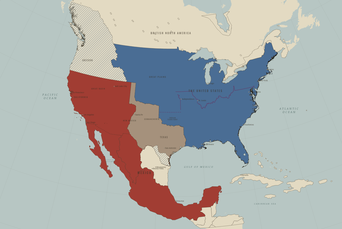
North America in 1840: A continent of rival claims. The map shows who held what: The Union, Mexico, 1840–54.
Open this map in the interactive atlas →
WW2 is free in full, and chapter 1 of every atlas is free. A free account opens 3 more chapters a day. Starter, at $9 a month, opens all 21 with no daily limit — see the plans.
Free printable American Civil War study guide, sent by email ↓
On the ground
- Mexico City claimed the far north, including Alta California and Nuevo México, beyond the Adams–Onís line established by the US–Spanish border treaty of 1819. In fact, Comanche, Apache, Navajo and Ute nations held the region as much as Mexican settlers did.
- The slaveholding Republic of Texas had been independent since 1836. The United States recognized it in 1837; Mexico never did.
- Texas claimed the Rio Grande as its boundary, while Mexico claimed the Nueces. Taylor’s army marched into the disputed strip in March 1846, and the war began there.
- Britain and the United States jointly occupied the Oregon Country west of the Rockies from 1818 until the 49th-parallel treaty of 15 June 1846.
Related maps
THE FREE PRINTABLE STUDY GUIDE
Get the printable study guide for The American Civil War free. I’ll send you a few short letters, then one when a new atlas opens. That’s all. — Paul
NO TRACKING · YOUR ADDRESS IS USED FOR THE DISPATCH AND NOTHING ELSE · UNSUBSCRIBE ANYTIME