MAPS OF HISTORY · ON THIS DAY · MARCH 21 · Battle of Bentonville (1865)ON THIS DAY · 21 MARCH 1865
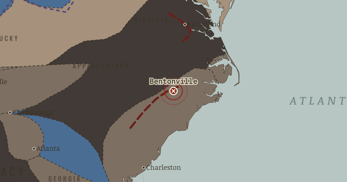
Battle of Bentonville
19–21 Mar 1865 — In North Carolina, Johnston’s hastily assembled army attacks one wing of Sherman’s force. The Confederacy’s last offensive is gallant and briefly successful, but its position is hopeless.
21 MARCH 1865 · THE AMERICAN CIVIL WAR, 1840–1877 These maps are reconstructed from published sources · US Military Academy: Principal Campaigns of the War · US Military Academy: Strategic Situation at the End of the Campaign, 27 February 1862 · US Military Academy: Southeastern United States, 1861 · US Military Academy: Chattanooga and Vicinity, 1863 – Movements Since 24 June · US Military Academy: Chattanooga and Vicinity, 1863 – Opening the Gateway, 30 September -17 October · US Military Academy: Grant’s Plan for the 1864 Campaign · US Military Academy: Sherman’s Turning Movement, 26 August 1864 · US Military Academy: Principal Federal Movements, November 1864 – April 1865 · US Military Academy: Capture of Weldon Railroad, 18 August 1864 · US Military Academy: The Defeat of Lee, 3-9 April 1865 · National Park Service: Port Royal and the Sea Islands · Cliopatria v 0.2.1 · Fort Donelson National Battlefield · Newberry Atlas of Historical County Boundaries: historical states and territories · Maps of History: Civil War source decisions · Appomattox Court House: the surrender and its aftermath
Source details US Military Academy Department of History; selected geographic facts reconstructed independently, original chart retained outside distributed files.. Geographic evidence only. Source atlas index requests reprint permission; original artwork not redistributed. US Military Academy Department of History; selected geographic facts reconstructed independently, original chart retained outside distributed files.. Geographic evidence only. Source atlas index requests reprint permission; original artwork not redistributed. US Military Academy Department of History; selected geographic facts reconstructed independently, original chart retained outside distributed files.. Geographic evidence only. Source atlas index requests reprint permission; original artwork not redistributed. US Military Academy Department of History; selected geographic facts reconstructed independently, original chart retained outside distributed files.. Geographic evidence only. Source atlas index requests reprint permission; original artwork not redistributed. US Military Academy Department of History; selected geographic facts reconstructed independently, original chart retained outside distributed files.. Geographic evidence only. Source atlas index requests reprint permission; original artwork not redistributed. US Military Academy Department of History; selected geographic facts reconstructed independently, original chart retained outside distributed files.. Geographic evidence only. Source atlas index requests reprint permission; original artwork not redistributed. US Military Academy Department of History; selected geographic facts reconstructed independently, original chart retained outside distributed files.. Geographic evidence only. Source atlas index requests reprint permission; original artwork not redistributed. US Military Academy Department of History; selected geographic facts reconstructed independently, original chart retained outside distributed files.. Geographic evidence only. Source atlas index requests reprint permission; original artwork not redistributed. US Military Academy Department of History; selected geographic facts reconstructed independently, original chart retained outside distributed files.. Geographic evidence only. Source atlas index requests reprint permission; original artwork not redistributed. US Military Academy Department of History; selected geographic facts reconstructed independently, original chart retained outside distributed files.. Geographic evidence only. Source atlas index requests reprint permission; original artwork not redistributed. National Park Service; November1861 Port Royal occupation. The early coastline layer is date-specific, not the entire1862 coastal gain.. US government historical geographic evidence Cliopatria contributors / Seshat Global History Databank. Selected, combined, reprojected and corrected by Maps of History as described per layer.. CC BY4.0 National Park Service; February1862 river forts and Nashville campaign.. US government historical geographic evidence The Newberry Library, Atlas of Historical County Boundaries. State/territory records unioned for the displayed date; disputed/joint territories excluded from exclusive US sovereignty.. Publisher permits commercial and noncommercial lawful reuse without fees; current terms supersede obsolete NC notice in archive Source-native legal boundaries, annual military control and independently reconstructed campaign sectors are kept separate. Region connectors and corridor widths are interpretive.. Original historical reconstruction with attributed evidence National Park Service; April9 surrender of Lee’s army. This does not by itself end all Confederate armies.. US government historical evidence Legal US boundaries come from dated Newberry records. Secession and military control use separate source layers, while campaign corridors are educational geographic reconstructions rather than surveyed continuous fronts.
reconstruction: 1845 · reconstruction: 1846 · reconstruction: 1861 · reconstruction: 1861-04-13 · reconstruction: 1861-07-21 · reconstruction: 1862-02-28 · reconstruction: 1862-06-08 · reconstruction: 1863 · reconstruction: 1863-07-10 · reconstruction: 1863-11-26 · reconstruction: 1864 · reconstruction: 1864-09-03 · reconstruction: 1864-12-22 · reconstruction: 1865 · reconstruction: 1865-02-20 · reconstruction: 1865-04-10 · reconstruction: August1864 Richmond/Petersburg siege sectors · reconstruction: February1865 campaign sector after Columbia; excludes the laterMarch Bentonville line · vector: 1860 state-interface reference · vector: us-e24e487b916d
Layer records and reconstruction methods
The moment in context For months, the lines around Petersburg seemed to hold. But Grant was attacking the means by which Lee could keep an army there. Railroads brought food and ammunition to Petersburg and Richmond; as Union troops extended their lines west toward those routes, Lee had to defend more ground with fewer men. Hunger and desertion further reduced his force. Sherman’s advance north through the Carolinas threatened to bring another Union army into the contest.
From Appomattox and the end of the war , chapter 11 of The American Civil War, 1840–1877 (APR 1865).
The place: Battle of Bentonville — map and full story →
Teach this in 5 minutes Why it happened — Why the end came fast. The defenses around Petersburg concealed a weakening supply system. Every westward extension brought Grant closer to the railroads carrying food and…The turn — Appomattox Court House, 9 April 1865. Lee did not surrender the largest force; Johnston would surrender more men. But Lee and his army held an exceptional place in the Confederacy, so…What it changed — Assassination changes the peace. Lincoln died just as the country moved from war to Reconstruction. Andrew Johnson, a Unionist Democrat with white-supremacist views, succeeded him;…Then ask the room: Did Grant’s generous surrender terms make Reconstruction’s later failure more likely? The argued answer is on the chapter page →
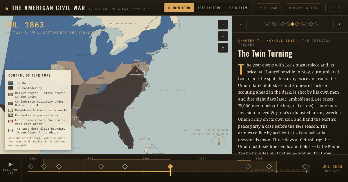
The atlas that shows it
THE FREE PRINTABLE STUDY GUIDE
Get the printable study guide for The American Civil War free. I’ll send you a few short letters, then one when a new atlas opens. That’s all. — Paul
NO TRACKING · YOUR ADDRESS IS USED FOR THE DISPATCH AND NOTHING ELSE ·
UNSUBSCRIBE ANYTIME