Two Roads to Independence: Haiti 1789–1838 and Kenya 1895–1978 · THE MAP IN
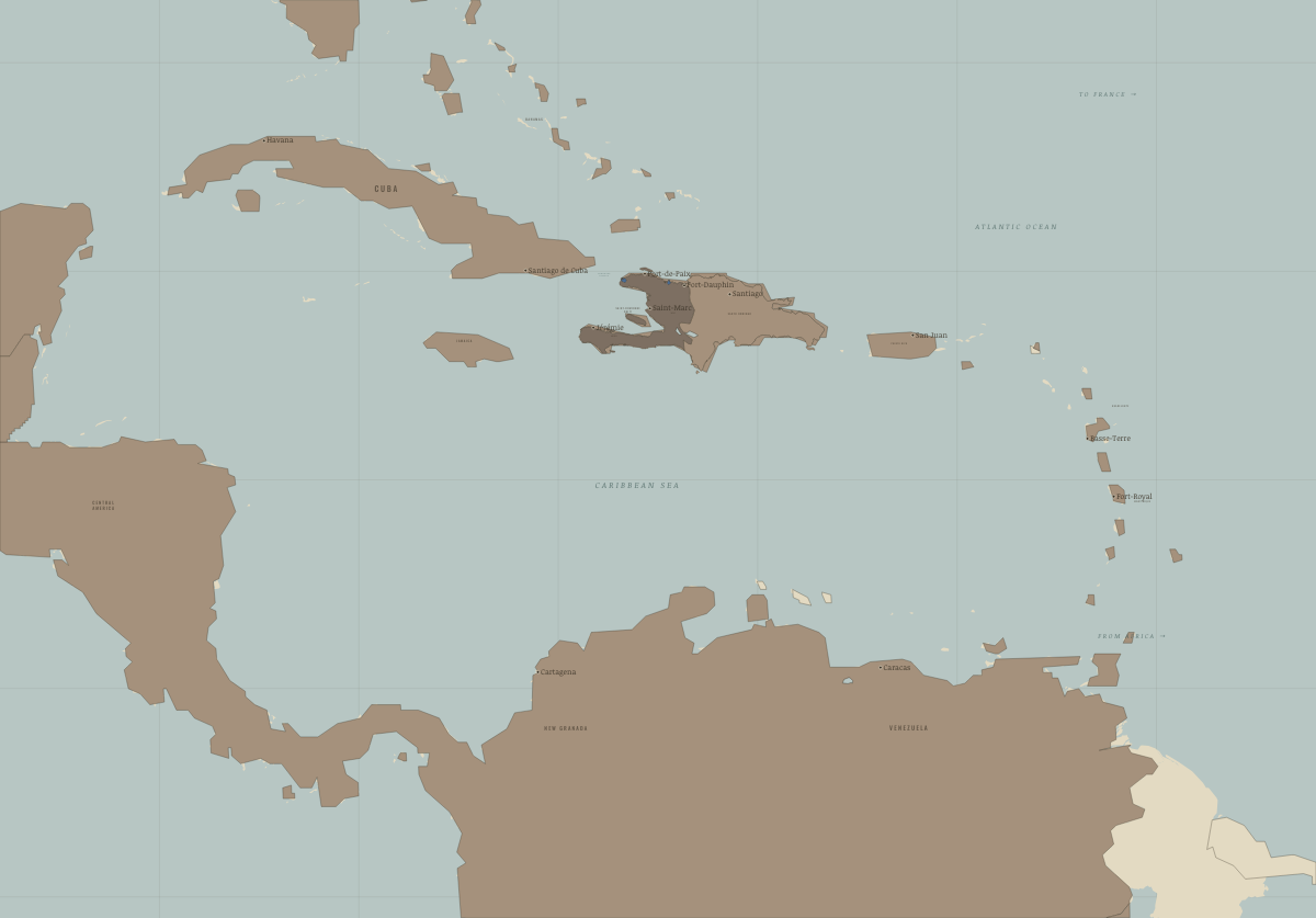
Map of Saint-Domingue in November 1803
Vertières — France holds only Le Cap and the Môle
Saint-Domingue in November 1803: Vertières — France holds only Le Cap and the Môle. Since June 1802, 1 territory changed status on this map: Saint-Domingue / Haiti.
WW2 is free in full, and chapter 1 of every atlas is free. A free account opens 3 more chapters a day. Starter, at $9 a month, opens all 21 with no daily limit — see the plans.
Free printable Haiti and Kenya independence study guide, sent by email ↓
What changes on the map
| Saint-Domingue / Haiti | Under colonial rule → Held by insurgents |
On the ground
- Le Cap, the last French stronghold in November 1803
- the Môle, which the French abandoned in December 1803
The chapters of this moment
Related maps
THE FREE PRINTABLE STUDY GUIDE
Get the printable study guide for Two Roads to Independence free. I’ll send you a few short letters, then one when a new atlas opens. That’s all. — Paul
NO TRACKING · YOUR ADDRESS IS USED FOR THE DISPATCH AND NOTHING ELSE · UNSUBSCRIBE ANYTIME