MAPS OF HISTORY · NORSE AND AZTECS · MAPS BY YEAR · 1150Climate and Innovation: The Norse and the Aztecs, c. 790–1521 · THE MAP AROUND c. 1150
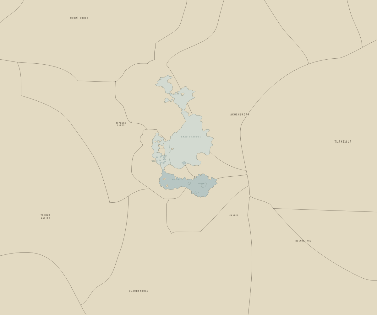
Map of the Basin of Mexico around 1150
The basin before the Mexica, after Tula’s fall
The Basin of Mexico around 1150: The basin before the Mexica, after Tula’s fall. The map shows who held what: Fresh or freshened lake water, Saline lake water, Chinampa fields.
c. 1150 · CLIMATE AND INNOVATION: THE NORSE AND THE AZTECS, C. 790–1521 These maps are reconstructed from published sources · Natural Earth administrative references · Basin of Mexico, c.1519 — published lake and causeway map · Hanns Prem: Tenochtitlan and islands in Texcoco Lake, 2008 · Mexico Secretariat of Culture / INAH: Tlatelolco archaeological-site location · Cliopatria v0.2.1 historical polities · GeoNames geographic controls · Natural Earth v5.1.2 full geographic reference · Aztec tribute provinces, 1519 — published vector map · Rio Verde Archaeology: independent Tututepec
Source details Natural Earth contributors. Public domain Yavidaxiu, Historicair, Sémhur and named Commons contributors. CC BY-SA 4.0 · Registered source paths and island holes. The two coarsely drawn city holes are superseded by the locally registered Prem city plan; all other shorelines remain. Farm-islet groupings and lake subdivisions are documented derivatives, shared under CC BY-SA 4.0. Hanns Prem. Public domain dedication by the author (PD-self), worldwide reuse for any purpose · Observed city-shoreline and named causeway pixels registered locally to temple/Tacuba/Chapultepec references. No area rescaling. Pixel observations, controls, matrix and review are published. Mexico Secretariat of Culture / INAH: Tlatelolco archaeological-site location. Historical facts cited; no source artwork or prose reproduced Cliopatria contributors / Seshat Global History Databank. CC BY 4.0 GeoNames contributors. CC BY 4.0 Natural Earth contributors. Public domain Yavidaxiu, Ssolbergj, Keepscases and Sémhur. CC BY-SA 3.0 · Registered original province edges; grouped into teaching regions. Published derivative geography and processing records available with attribution. Rio Verde Archaeology: independent Tututepec. Historical facts cited; no source artwork or prose reproduced These maps are reconstructed from published sources. The layer record provides the source geometry, registration controls, reference dates and derivatives.
Lake shores and tribute-region edges are registered from two published 1519 maps. The detailed Prem city plan supplies the central island and its five connecting routes. Where a better downloadable map was unavailable, earlier chapters deliberately reuse these later-source geographic references.
The lake-map control RMS is 2.67 km, and the regional province-map control RMS is 14.79 km. The separate local city fit has a 61 m control RMS and a 330 m leave-one-out RMS. These figures diagnose the control fits; they do not prove the exact position of ancient shorelines. Region grouping, strategic-site margins and independent-state substitutions are documented.
Chinampa layers identify islets mapped by the source in the named agricultural districts. Their filled areas are not a cadastral inventory of every field.
proxy: Lower Río Verde / coastal Oaxaca geographic reference · proxy: Published geographic reference; not a medieval administrative survey · reconstruction: c.1519 named strategic locality · trace: Conquest-era city reference; Prem plan published 2008 · trace: c.1519 published reconstruction · vector: 1497–1520
Layer records and reconstruction methods
Related maps
◧ EMBED THIS MAP ON YOUR SITE
You may embed this map free if you keep the attribution link. Teachers can find print-ready
study guides at /study/ .
THE FREE PRINTABLE STUDY GUIDE
Get the printable study guide for Climate and Innovation free. I’ll send you a few short letters, then one when a new atlas opens. That’s all. — Paul
NO TRACKING · YOUR ADDRESS IS USED FOR THE DISPATCH AND NOTHING ELSE ·
UNSUBSCRIBE ANYTIME