The American Civil War, 1840–1877 · THE MAP IN
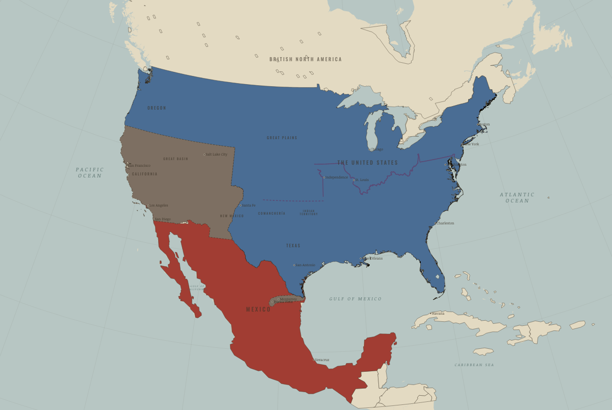
Map of North America in December 1846
Santa Fe, California, Monterrey
North America in December 1846: Santa Fe, California, Monterrey. The map shows who held what: The Union, Mexico, 1840–54.
Open this map in the interactive atlas →
WW2 is free in full, and chapter 1 of every atlas is free. A free account opens 3 more chapters a day. Starter, at $9 a month, opens all 21 with no daily limit — see the plans.
Free printable American Civil War study guide, sent by email ↓
On the ground
- California and New Mexico came under US military government. Kearny took Santa Fe without a fight in August 1846, but the Californios fought back, as did participants in the Taos rising of January 1847.
- Taylor’s army occupied northeastern Mexico, including Matamoros, Monterrey, Saltillo and the Tampico coast.
Related maps
THE FREE PRINTABLE STUDY GUIDE
Get the printable study guide for The American Civil War free. I’ll send you a few short letters, then one when a new atlas opens. That’s all. — Paul
NO TRACKING · YOUR ADDRESS IS USED FOR THE DISPATCH AND NOTHING ELSE · UNSUBSCRIBE ANYTIME