China in Revolution, 1911–1949 · THE MAP IN
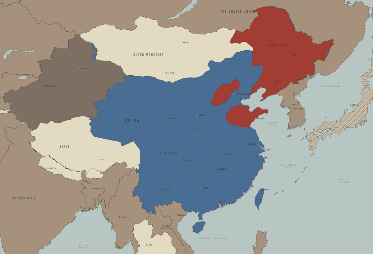
Map of China in 1948
Liaoshen and Huaihai — the north goes red
China in 1948: Liaoshen and Huaihai — the north goes red. The map shows who held what: Foreign empires — British, French, Russian, American, The Republic of China — the government at the time, Japan defeated and under occupation (1945).
WW2 is free in full, and chapter 1 of every atlas is free. A free account opens 3 more chapters a day. Starter, at $9 a month, opens all 21 with no daily limit — see the plans.
Free printable Chinese Revolution study guide, sent by email ↓
On the ground
- By November 1948, after Liaoshen, all of Manchuria was Communist-controlled. It was China’s strongest industrial region.
The chapters of this moment
Related maps
THE FREE PRINTABLE STUDY GUIDE
Get the printable study guide for China in Revolution free. I’ll send you a few short letters, then one when a new atlas opens. That’s all. — Paul
NO TRACKING · YOUR ADDRESS IS USED FOR THE DISPATCH AND NOTHING ELSE · UNSUBSCRIBE ANYTIME